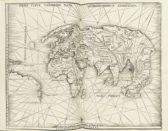
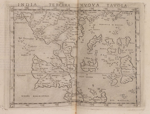
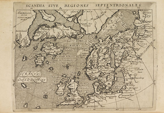
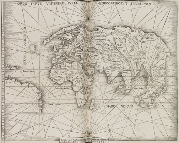
Claudius Ptolemaeus La geografia. Nuouamente tradotta di Greco in Italiano da G. Ruscelli. 3 Teile in 1 Band. Venedig, V. Valgrisi 1561. "A new and important edition in Italian, with a new series of maps." (Henry N. Stevens) Erste Ausgabe der Übersetzung von Ptolemaeus' Geographie durch G. Ruscelli, gefolgt von einer Epositioni Ruscellis "sopra tutta la Geografia di Tolomeo" und einem Discorso universale von Giuseppe Moletto, "matematico". Neben den 27 ptolemaeischen Karten enthält das Werk 37 "moderne" Karten, darunter 3 Weltkarten (Shirley 109-111), von denen Orbis pictus die Welt erstmals in einem Atlas nicht in einzelnen, sondern in zwei miteinander verknüpften Hemisphären darstellt ("elegantly designed and engraved", Sh. 110), ferner 6 Karten zu Amerika (u. a. Burden 29-30) u. a. - Die 24 Bll. Tavola de nomi (mit Errata u. Anweisung an den Buchbinder) in diesem Exemplar ans Ende gebunden. EINBAND: Pergamentband der Zeit mit handschriftlichem Rückentitel. Quarto. 24,5 : 18 cm. - ILLUSTRATION: Mit 64 doppelblattgroßen Kupferkarten (mit Rückentext) und einigen tlw. ganzseitigen Textholzschnitten. - KOLLATION: 4 nn. Bll., 358 S., 1 Bl.; 28 Bll., 47 S., 24 Bll. - ZUSTAND: Im Rand stellenw. gering wasserfleckig, ca. 13 Karten mit Wasserfleck oder kl. Leimspuren im Rand, Karten mit Pergamentstreifen angefalzt, dadurch ca. 13 Karten mit kl. Riß parallel zur Mittelfalte, Vorsätze erneuert und vorne mit hs. Eintrag, Titel verso mit Stempel. Einbd. fleckig. - PROVENIENZ: Aus der Sammlung Per Hierta (1864-1922). LITERATUR: BM STC, Italian Books S. 543. - Edit 16, CNCE 38126. - Phillips/Le Gear 5915. - Sabin 66503. - Stevens S. 50. First edition of Ruscelli's translation of Ptolemy's "Geography". With 27 ptolemaic maps and 37 modern maps (incl. 3 world maps and 6 maps of America), all in doublepage copper engravings with text on verso, with a few woodcut illustrations in the text (partly fullpage). 3 parts in 1 volume. Contemp. vellum with ms. title on spine. - Margins occasionally slightly waterstained, about 13 maps with small waterstaining or traces of glue in the margins, maps inserted on vellum guards, causing small tears near to the centrefold of ca. 13 maps, endpapers renewed and with ms. entry in front, title verso with library stamp. Binding stained. - Per Hierta copy.
Claudius Ptolemaeus La geografia. Nuouamente tradotta di Greco in Italiano da G. Ruscelli. 3 Teile in 1 Band. Venedig, V. Valgrisi 1561. "A new and important edition in Italian, with a new series of maps." (Henry N. Stevens) Erste Ausgabe der Übersetzung von Ptolemaeus' Geographie durch G. Ruscelli, gefolgt von einer Epositioni Ruscellis "sopra tutta la Geografia di Tolomeo" und einem Discorso universale von Giuseppe Moletto, "matematico". Neben den 27 ptolemaeischen Karten enthält das Werk 37 "moderne" Karten, darunter 3 Weltkarten (Shirley 109-111), von denen Orbis pictus die Welt erstmals in einem Atlas nicht in einzelnen, sondern in zwei miteinander verknüpften Hemisphären darstellt ("elegantly designed and engraved", Sh. 110), ferner 6 Karten zu Amerika (u. a. Burden 29-30) u. a. - Die 24 Bll. Tavola de nomi (mit Errata u. Anweisung an den Buchbinder) in diesem Exemplar ans Ende gebunden. EINBAND: Pergamentband der Zeit mit handschriftlichem Rückentitel. Quarto. 24,5 : 18 cm. - ILLUSTRATION: Mit 64 doppelblattgroßen Kupferkarten (mit Rückentext) und einigen tlw. ganzseitigen Textholzschnitten. - KOLLATION: 4 nn. Bll., 358 S., 1 Bl.; 28 Bll., 47 S., 24 Bll. - ZUSTAND: Im Rand stellenw. gering wasserfleckig, ca. 13 Karten mit Wasserfleck oder kl. Leimspuren im Rand, Karten mit Pergamentstreifen angefalzt, dadurch ca. 13 Karten mit kl. Riß parallel zur Mittelfalte, Vorsätze erneuert und vorne mit hs. Eintrag, Titel verso mit Stempel. Einbd. fleckig. - PROVENIENZ: Aus der Sammlung Per Hierta (1864-1922). LITERATUR: BM STC, Italian Books S. 543. - Edit 16, CNCE 38126. - Phillips/Le Gear 5915. - Sabin 66503. - Stevens S. 50. First edition of Ruscelli's translation of Ptolemy's "Geography". With 27 ptolemaic maps and 37 modern maps (incl. 3 world maps and 6 maps of America), all in doublepage copper engravings with text on verso, with a few woodcut illustrations in the text (partly fullpage). 3 parts in 1 volume. Contemp. vellum with ms. title on spine. - Margins occasionally slightly waterstained, about 13 maps with small waterstaining or traces of glue in the margins, maps inserted on vellum guards, causing small tears near to the centrefold of ca. 13 maps, endpapers renewed and with ms. entry in front, title verso with library stamp. Binding stained. - Per Hierta copy.


.jpg)


.jpg)


Try LotSearch and its premium features for 7 days - without any costs!
Be notified automatically about new items in upcoming auctions.
Create an alert