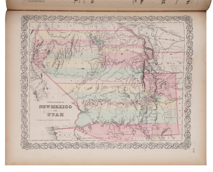
Title: Colton's Atlas of the World, Illustrating Physical and Political Geography by George W. Colton. Accompanied by Descriptions, Geographical, Statistical, and Historical, by Richard Swainson Fisher...Volume I.--North and South America, Etc. Author: Colton, George W. Place: New York Publisher: J. H. Colton & Co. Date: 1855 Description: Volume 1 only (of 2). With 61 hand-colored maps (2 are double-page), plus insets, and 1 plate with 4 maps not colored, all on 59 map-sheets; steel-engraved plate before title page. (Folio) 18½x16, original ¼ morocco and cloth, spine and front cover decoratively stamped and lettered in gilt, rear cover similarly stamped in blind. Volume 1 of Colton’s important "Atlas of the World" published in the mid-1850’s. With U.S. maps, of: Nebraska and Kanzas (sic) with an extra large Nebraska, no Montana and portions of Washington, Oregon, Minnesota, Iowa, Missouri and Wisconsin; Texas with two inset plans for Galveston Bay and Sabine Lake and shows roads and trails going into Mexico; map for the Territories of New Mexico and Utah showing Fremont's 1844-45 routes; California with an inset of San Francisco and shows Atlantic and Pacific R.R. lines; Washington and Oregon Territories with extended land mass. Also, nice double-page maps of the United States and New York City; plus city plans for Boston, Philadelphia, Baltimore, Washington DC, Savannah, Charleston, Louisville, New Orleans, Pittsburgh, Cincinnati, St. Louis, and Chicago. Lot Amendments Condition: Covers detached along with endpapers, engraved plate at front and final text leaf, backstrip detached and lacking several pieces, edges worn; a few maps with small chips in margins; maps overall clean and very good or better condition. Item number: 144292
Title: Colton's Atlas of the World, Illustrating Physical and Political Geography by George W. Colton. Accompanied by Descriptions, Geographical, Statistical, and Historical, by Richard Swainson Fisher...Volume I.--North and South America, Etc. Author: Colton, George W. Place: New York Publisher: J. H. Colton & Co. Date: 1855 Description: Volume 1 only (of 2). With 61 hand-colored maps (2 are double-page), plus insets, and 1 plate with 4 maps not colored, all on 59 map-sheets; steel-engraved plate before title page. (Folio) 18½x16, original ¼ morocco and cloth, spine and front cover decoratively stamped and lettered in gilt, rear cover similarly stamped in blind. Volume 1 of Colton’s important "Atlas of the World" published in the mid-1850’s. With U.S. maps, of: Nebraska and Kanzas (sic) with an extra large Nebraska, no Montana and portions of Washington, Oregon, Minnesota, Iowa, Missouri and Wisconsin; Texas with two inset plans for Galveston Bay and Sabine Lake and shows roads and trails going into Mexico; map for the Territories of New Mexico and Utah showing Fremont's 1844-45 routes; California with an inset of San Francisco and shows Atlantic and Pacific R.R. lines; Washington and Oregon Territories with extended land mass. Also, nice double-page maps of the United States and New York City; plus city plans for Boston, Philadelphia, Baltimore, Washington DC, Savannah, Charleston, Louisville, New Orleans, Pittsburgh, Cincinnati, St. Louis, and Chicago. Lot Amendments Condition: Covers detached along with endpapers, engraved plate at front and final text leaf, backstrip detached and lacking several pieces, edges worn; a few maps with small chips in margins; maps overall clean and very good or better condition. Item number: 144292


Try LotSearch and its premium features for 7 days - without any costs!
Be notified automatically about new items in upcoming auctions.
Create an alert