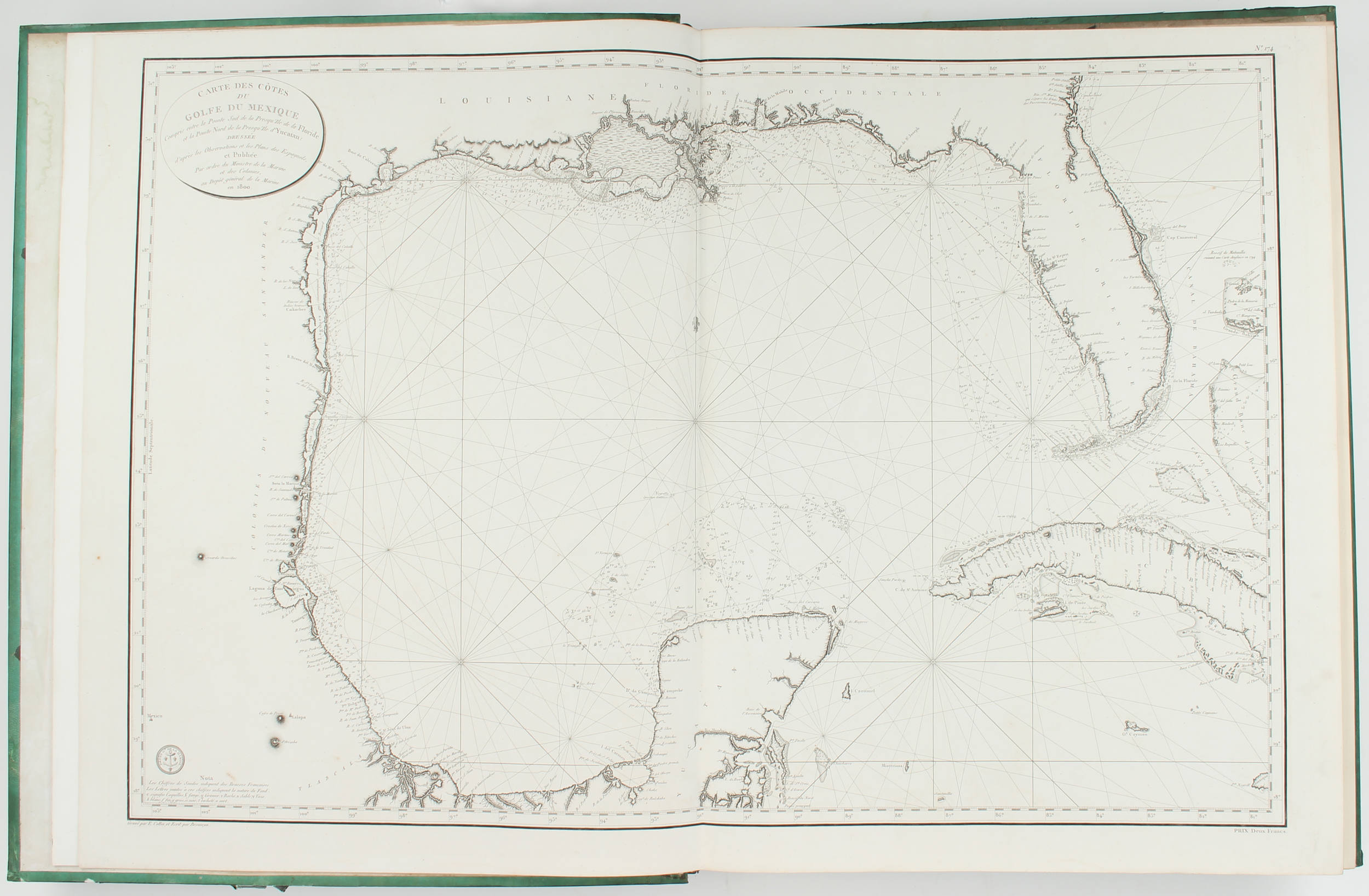
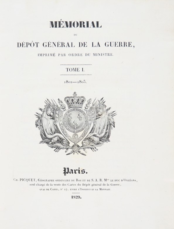
DEPOT-GENERAL DE LA MARINE. Hydrographie Française [thus titled on spines]. Paris: [1758-1833]. A mighty 12 volume set, containing probably the largest grouping in private hands of the official navigational charts available for use in France at the beginning of the 19th century. The printing history of these charts is, and remains, complex. Some of the charts, such as those of the Baltic and North Sea coasts found in volume 1, were published as early as 1693 when they were issued in the Jaillot and Mortier Le Neptune fran ç ois . The earliest maps in this collection are those of the islands of St Christopher, Antigua (vol. 9) and Barbados (vol. 10) in the Caribbean, all dated 1758. Vols 8-10 focus on the Americas, with a few other relevant charts scattered in vols 11 and 12. There is quite a large focus on the Canadian north-eastern seaboard with approximately 25 maps on Newfoundland and various islands and coasts at the mouth of the St Lawrence; many of these are French editions of English surveys, such as those of Cook and Lane. The USA is represented by plans of Boston, Rhode Island, the eastern seaboard from New Jersey south to Florida, Chesapeake Bay, the Carolinas and northern Florida. These continue in vol. 9 with maps of the Gulf of Mexico, Central America, the northern coast of South America and the Caribbean; vol. 10 is mainly dedicated to South America, with further South American maps in vol. 12. These latter are the latest in the collection, dated 1833. Asia, particularly French Indochina and Cochin China, is delineated in vol. 11, alongside a large three-sheet map of Arabia and the Red Sea dated 1798. Vol. 2 features maps of the British Isles, vols 3, 4 and 6 France, vol. 5 focuses on Spain and Portugal, while vol. 7 centres on the Mediterranean including some wonderful charts of the Greek archipelago. The collection is bound in a robust institutional style binding, with strong metal fixtures securing the maps. Evidently some of the charts have been removed from the volumes, but overall it retains its integrity, and reflects an institutional requirement of issuing updated charts to replace those either lost or bearing obsolete information. cf. NMM III(1), 250-259. 12 volumes, very large folio (664 x 570mm). 480 engraved charts mounted on guards, of which 325 double-page and 155 single-page, 9 charts in vol. 1 and 3 charts in vol. 3 coloured in outline , all with the Depot-General de la Marine device in corners, charts by or after Sartine, Jaillot, Bellin, Beautemps-Beaupre, Vincente Tofino de San Miguel and many others , many showing additions, amendments or retouches (evidence of a number of maps removed with remains of guards present and locked into place - see binding description below, vol. 4 affected by damp throughout, vol. 8 with some top corners of charts affected by damp, a few light water-stains elsewhere, some scattered browning and spotting, but mostly in fine condition). 19th-century institutional binding of black morocco-backed boards covered with green glazed paper, the spines titled and ruled in gilt, the guards secured by metal retaining strips which are locked into position at head and tail, each volume with a locking pin attached to a cotton cord and inserted into the rear pastedowns (extremities lightly rubbed, one pin loose).
DEPOT-GENERAL DE LA MARINE. Hydrographie Française [thus titled on spines]. Paris: [1758-1833]. A mighty 12 volume set, containing probably the largest grouping in private hands of the official navigational charts available for use in France at the beginning of the 19th century. The printing history of these charts is, and remains, complex. Some of the charts, such as those of the Baltic and North Sea coasts found in volume 1, were published as early as 1693 when they were issued in the Jaillot and Mortier Le Neptune fran ç ois . The earliest maps in this collection are those of the islands of St Christopher, Antigua (vol. 9) and Barbados (vol. 10) in the Caribbean, all dated 1758. Vols 8-10 focus on the Americas, with a few other relevant charts scattered in vols 11 and 12. There is quite a large focus on the Canadian north-eastern seaboard with approximately 25 maps on Newfoundland and various islands and coasts at the mouth of the St Lawrence; many of these are French editions of English surveys, such as those of Cook and Lane. The USA is represented by plans of Boston, Rhode Island, the eastern seaboard from New Jersey south to Florida, Chesapeake Bay, the Carolinas and northern Florida. These continue in vol. 9 with maps of the Gulf of Mexico, Central America, the northern coast of South America and the Caribbean; vol. 10 is mainly dedicated to South America, with further South American maps in vol. 12. These latter are the latest in the collection, dated 1833. Asia, particularly French Indochina and Cochin China, is delineated in vol. 11, alongside a large three-sheet map of Arabia and the Red Sea dated 1798. Vol. 2 features maps of the British Isles, vols 3, 4 and 6 France, vol. 5 focuses on Spain and Portugal, while vol. 7 centres on the Mediterranean including some wonderful charts of the Greek archipelago. The collection is bound in a robust institutional style binding, with strong metal fixtures securing the maps. Evidently some of the charts have been removed from the volumes, but overall it retains its integrity, and reflects an institutional requirement of issuing updated charts to replace those either lost or bearing obsolete information. cf. NMM III(1), 250-259. 12 volumes, very large folio (664 x 570mm). 480 engraved charts mounted on guards, of which 325 double-page and 155 single-page, 9 charts in vol. 1 and 3 charts in vol. 3 coloured in outline , all with the Depot-General de la Marine device in corners, charts by or after Sartine, Jaillot, Bellin, Beautemps-Beaupre, Vincente Tofino de San Miguel and many others , many showing additions, amendments or retouches (evidence of a number of maps removed with remains of guards present and locked into place - see binding description below, vol. 4 affected by damp throughout, vol. 8 with some top corners of charts affected by damp, a few light water-stains elsewhere, some scattered browning and spotting, but mostly in fine condition). 19th-century institutional binding of black morocco-backed boards covered with green glazed paper, the spines titled and ruled in gilt, the guards secured by metal retaining strips which are locked into position at head and tail, each volume with a locking pin attached to a cotton cord and inserted into the rear pastedowns (extremities lightly rubbed, one pin loose).


.jpg)


Try LotSearch and its premium features for 7 days - without any costs!
Be notified automatically about new items in upcoming auctions.
Create an alert