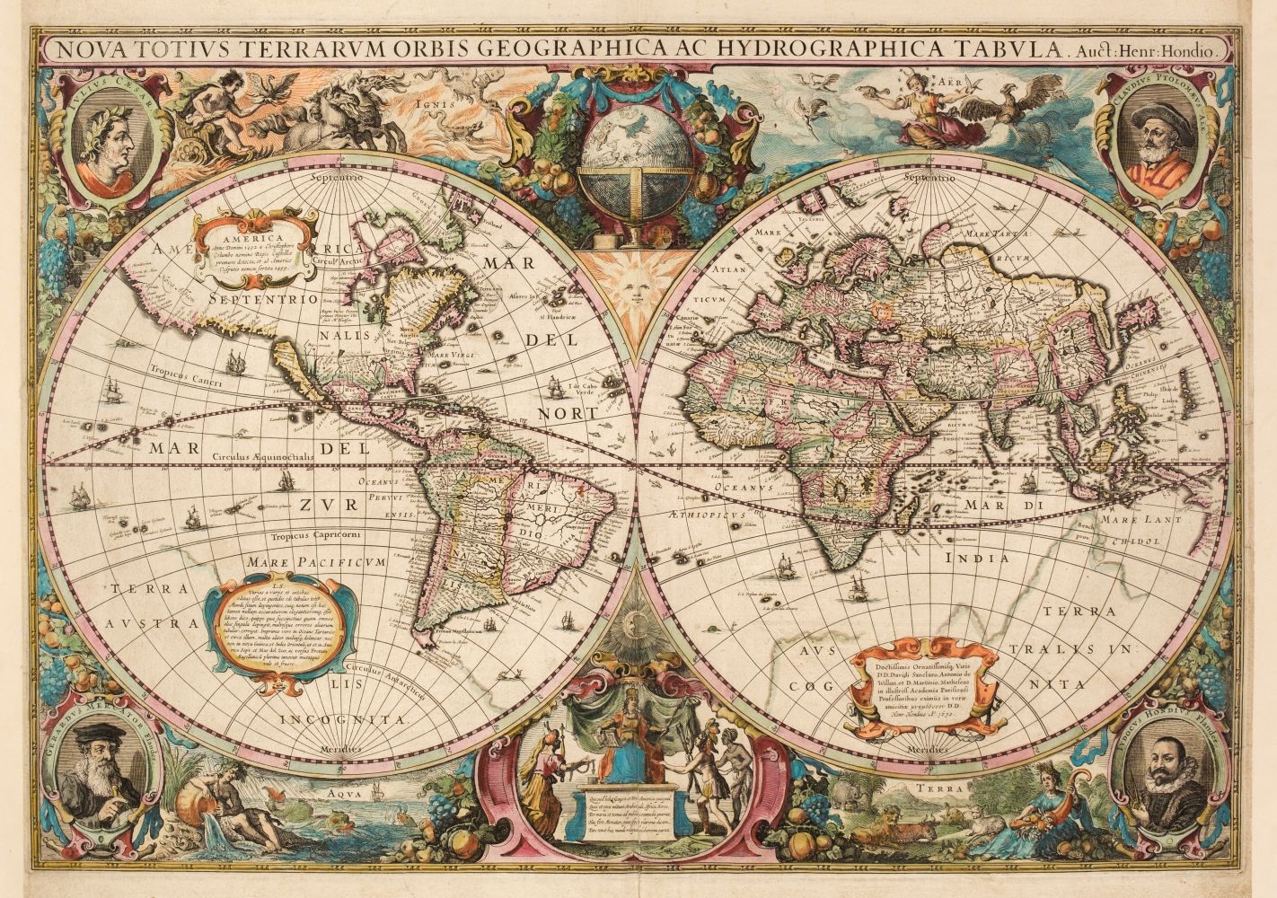
HONDIUS, Henricus (1597-1651). [WORLD AND CONTINENTS] -- Nova Totius Terrarum Orbis Geographica ac Hydrographica Tabula . Amsterdam: Johannes Janssonius 1630. Hand-coloured engraved twin hemisphere map of the world (376 x 542mm). Embellished with spandrel allegorical vignettes representing the four elements and portrait cartouches of Julius Caesar Claudius Ptolomaeus, Gerard Mercator and Jodocus Hondius at each corner. (Some very light staining.) Window mount. Together with a set of Continent maps: Europa Exactissime Descripta ; Africae Nova Tabula ; Asia recens summa cura delineata ; America . [Amsterdam:] 1631. 4 hand-coloured engraved maps of Europe, Africa, Asia and America (each c.374 x 505mm). Titles set in decorative cartouches, seas decorated with sea monsters and galleons, continents decorated with beasts. (Africa and Asia with very light staining.) Window mounts. A FINE GROUP OF WORLD AND CONTINENT MAPS from the Mercator-Hondius atlas. (5)
HONDIUS, Henricus (1597-1651). [WORLD AND CONTINENTS] -- Nova Totius Terrarum Orbis Geographica ac Hydrographica Tabula . Amsterdam: Johannes Janssonius 1630. Hand-coloured engraved twin hemisphere map of the world (376 x 542mm). Embellished with spandrel allegorical vignettes representing the four elements and portrait cartouches of Julius Caesar Claudius Ptolomaeus, Gerard Mercator and Jodocus Hondius at each corner. (Some very light staining.) Window mount. Together with a set of Continent maps: Europa Exactissime Descripta ; Africae Nova Tabula ; Asia recens summa cura delineata ; America . [Amsterdam:] 1631. 4 hand-coloured engraved maps of Europe, Africa, Asia and America (each c.374 x 505mm). Titles set in decorative cartouches, seas decorated with sea monsters and galleons, continents decorated with beasts. (Africa and Asia with very light staining.) Window mounts. A FINE GROUP OF WORLD AND CONTINENT MAPS from the Mercator-Hondius atlas. (5)


Try LotSearch and its premium features for 7 days - without any costs!
Be notified automatically about new items in upcoming auctions.
Create an alert