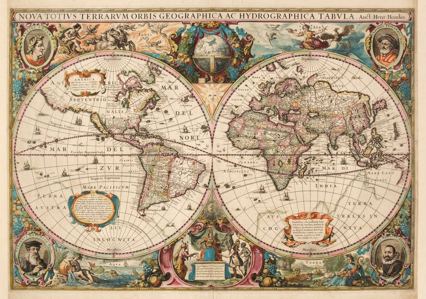
HONDIUS, HENRICUS. Nova Totius Terrarum Orbis Geographica et Hydrographica. Amsterdam 1630 [1636]. Engraved map, single sheet, 453 x 564 mm. (12 7/8 x 22 1/8 in.), repaired tear along centerfold, small repaired tears to outer margins, a corner restored, washed and pressed, slight uniform discoloration . Engraved twin-hemispherical map of the world, state 1 (of 4), elaborate border decoration including allegorical vignettes of the four elements and medallion portraits of Julius Caesar Mercator, Ptolemy and Hondius, English text on verso. Koeman II, Me 41A, map 1; Shirley 336. First state of the revised and improved world map produced by Hondius and his partner Jan Jansson in 1629 for the Mercator-Hondius atlas, the preceding editions of which had been using the same world map for 35 years. "For geographical detail Hondius has followed Speed and his contemporaries and also presents California as an island. New features include part of the Australia coastline extending towards New Guinea and a redrawing of north-east Canada with 'Queen Anne's forland' (Baffin Island) shown completely encircled by open water. The Hondius-Jansson world map had as long a life as its predecessor, as it was included in all issues of the Mercator atlas from 1633 until at least 1658" (Shirley). This copy is from the English edition of 1636.
HONDIUS, HENRICUS. Nova Totius Terrarum Orbis Geographica et Hydrographica. Amsterdam 1630 [1636]. Engraved map, single sheet, 453 x 564 mm. (12 7/8 x 22 1/8 in.), repaired tear along centerfold, small repaired tears to outer margins, a corner restored, washed and pressed, slight uniform discoloration . Engraved twin-hemispherical map of the world, state 1 (of 4), elaborate border decoration including allegorical vignettes of the four elements and medallion portraits of Julius Caesar Mercator, Ptolemy and Hondius, English text on verso. Koeman II, Me 41A, map 1; Shirley 336. First state of the revised and improved world map produced by Hondius and his partner Jan Jansson in 1629 for the Mercator-Hondius atlas, the preceding editions of which had been using the same world map for 35 years. "For geographical detail Hondius has followed Speed and his contemporaries and also presents California as an island. New features include part of the Australia coastline extending towards New Guinea and a redrawing of north-east Canada with 'Queen Anne's forland' (Baffin Island) shown completely encircled by open water. The Hondius-Jansson world map had as long a life as its predecessor, as it was included in all issues of the Mercator atlas from 1633 until at least 1658" (Shirley). This copy is from the English edition of 1636.


Try LotSearch and its premium features for 7 days - without any costs!
Be notified automatically about new items in upcoming auctions.
Create an alert