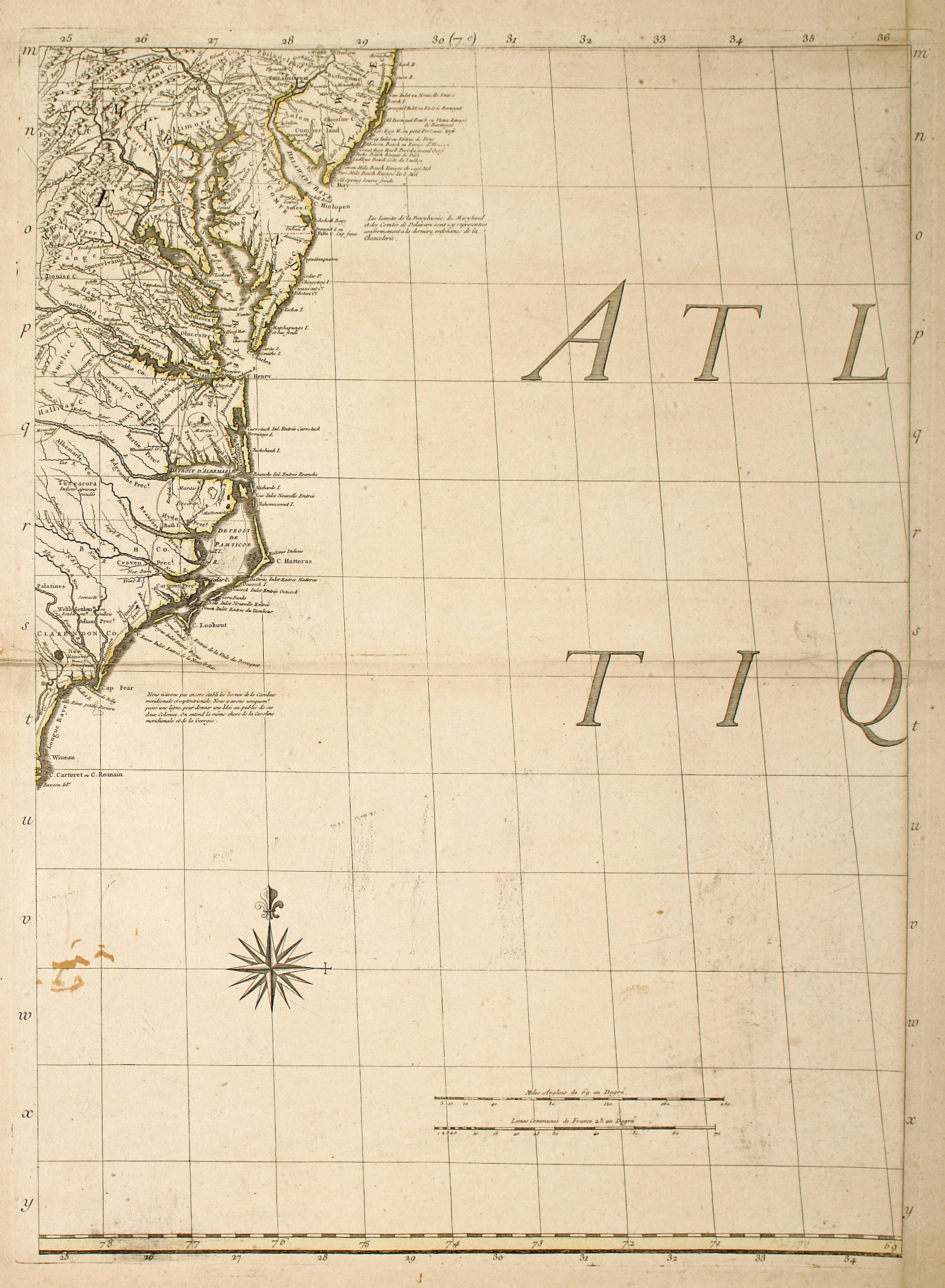
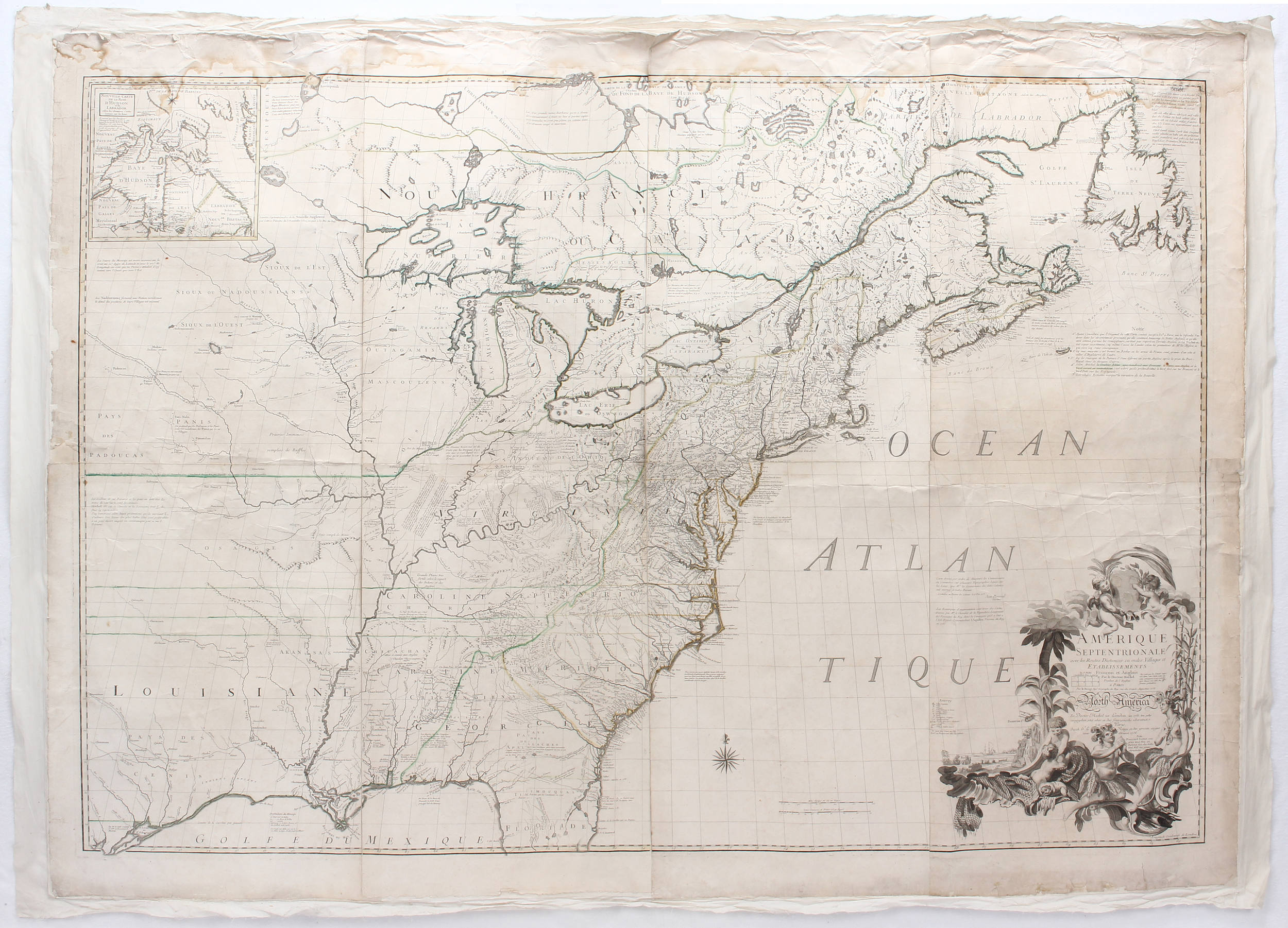
MITCHELL, JOHN. Amerique Septentrionale avec les Routes, Distance en miles, Villages et Etablissements François et Anglois. Paris: Le Rouge 1756. Large engraved wall-map on eight double-page mapsheets, platemark of each c. 683 x 497 mm. (26 7/8 x 19 5/8 in.), deckle edges, a very few short marginal tears (two repaired), minor diagonal crease to three sheets, some soft creasing along center folds, occasional very light spotting; each sheet separately framed . Second French edition, first impression, and the third edition overall, large engraved allegorical cartouche, inset map of Hudson's Bay and Labrador, partially hand-colored in outline. E. and D. S. Berkeley, Dr. John Mitchell the Man who made the Map , Chapel Hill 1974, chapters 12 and 13; Cumming, The Southeast in Early Maps , Chapel Hill 1962, no. 293 and pp. 47-49; Walter Ristow, "John Mitchell's Map...", in A la Carte, Selected Papers on Maps and Atlases , Washington 1972, pp. 102-113. A FINE COPY. "POLITICALLY AND HISTORICALLY...MITCHELL'S MAP IS THE MOST IMPORTANT IN AMERICAN HISTORY" (Cumming, p. 47). Commissioned by the British Commissioners of Trade and Plantations in 1750, and five years in the making, Mitchell's map, the second large-scale map of the Americas after Popple's 1733 Map of the British Empire in America , is greatly superior to its predecessor in accuracy and detail, as Mitchell was able to make use of the rich collection of manuscript maps and geographical material in the archives of the Board of Trade. It is "a political map, showing the division of eastern North America between the British and the French and the administrative subdivisions of the British North American Colonies. The map also has roads...and gives the positions of the principal Indian tribes, as well as extensive notes regarding the dates of various settlements, the nature of the country, and so forth..." (Hunter Miller, Ed. Treaties and Other International Acts of the United States , vol. 3, Washington 1933, p. 330, cited in Ristow, p. 106). Its fame derives, however, from the uses to which it was put years after its publication (it appeared in numerous editions, English, French, Dutch and Italian): it was notably the single cartographic document consulted by the representatives of Great Britain and the United States in the negotiations leading to the signing of the Treaty of Paris in 1783. (8)
MITCHELL, JOHN. Amerique Septentrionale avec les Routes, Distance en miles, Villages et Etablissements François et Anglois. Paris: Le Rouge 1756. Large engraved wall-map on eight double-page mapsheets, platemark of each c. 683 x 497 mm. (26 7/8 x 19 5/8 in.), deckle edges, a very few short marginal tears (two repaired), minor diagonal crease to three sheets, some soft creasing along center folds, occasional very light spotting; each sheet separately framed . Second French edition, first impression, and the third edition overall, large engraved allegorical cartouche, inset map of Hudson's Bay and Labrador, partially hand-colored in outline. E. and D. S. Berkeley, Dr. John Mitchell the Man who made the Map , Chapel Hill 1974, chapters 12 and 13; Cumming, The Southeast in Early Maps , Chapel Hill 1962, no. 293 and pp. 47-49; Walter Ristow, "John Mitchell's Map...", in A la Carte, Selected Papers on Maps and Atlases , Washington 1972, pp. 102-113. A FINE COPY. "POLITICALLY AND HISTORICALLY...MITCHELL'S MAP IS THE MOST IMPORTANT IN AMERICAN HISTORY" (Cumming, p. 47). Commissioned by the British Commissioners of Trade and Plantations in 1750, and five years in the making, Mitchell's map, the second large-scale map of the Americas after Popple's 1733 Map of the British Empire in America , is greatly superior to its predecessor in accuracy and detail, as Mitchell was able to make use of the rich collection of manuscript maps and geographical material in the archives of the Board of Trade. It is "a political map, showing the division of eastern North America between the British and the French and the administrative subdivisions of the British North American Colonies. The map also has roads...and gives the positions of the principal Indian tribes, as well as extensive notes regarding the dates of various settlements, the nature of the country, and so forth..." (Hunter Miller, Ed. Treaties and Other International Acts of the United States , vol. 3, Washington 1933, p. 330, cited in Ristow, p. 106). Its fame derives, however, from the uses to which it was put years after its publication (it appeared in numerous editions, English, French, Dutch and Italian): it was notably the single cartographic document consulted by the representatives of Great Britain and the United States in the negotiations leading to the signing of the Treaty of Paris in 1783. (8)


Try LotSearch and its premium features for 7 days - without any costs!
Be notified automatically about new items in upcoming auctions.
Create an alert