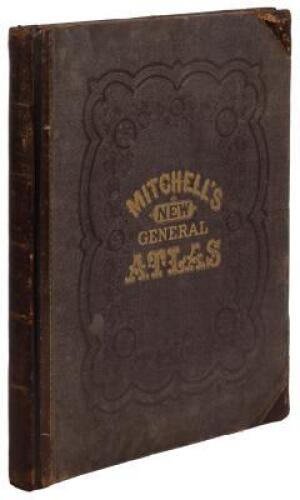
Title: Mitchell's New General Atlas, Containing Maps of the Various Countries of the World, Plans of Cities, Etc....[and] White's New County and District Atlas of the State of West Virginia, Comprising Fifty-Four Counties... Author: Mitchell, S[amuel] Augustus Place: Philadelphia / Grafton, WV Publisher: S. Augustus Mitchell / M. Wood White Date: 1873 Description: Two atlases, bound together. [2], 72; [4], [13], [1 ad leaf], [15], [6], 27, [4] pp. Mitchell Atlas with 68 hand-colored maps (12 are double-page) on 60 map-sheets, plus insets and a hand-colored Time-Table leaf; White’s West Virginia Atlas with 47 hand-colored maps (2 are double-page) including insets, on 26 map-sheets, drawn by William H. Gamble, examined and corrected by M.A. Miller. Together, 115 total maps on 86 map-sheets. 15¼x12¼, original half brown sheep and decoratively blind-stamped cloth covers, lettered in gilt. Double-page maps include: The World; The United States (with inset); Plan of Boston; State of New York (with 5 insets); New York and Brooklyn; Georgia and Alabama (with 2 insets); Arkansas, Mississippi, Louisiana; Texas (Galveston inset); Michigan and Wisconsin; Kansas, Nebraska, Colorado, Dakota, Wyoming & Montana; California (2 insets); Central America and the West Indies (with 4 insets); and Wheeling, WV. Most of the maps pertain to the Americas, chiefly of U.S. states and cities, such as: New York, Boston, Philadelphia, Baltimore, Washington DC, New Orleans, Cincinnati, Chicago, St. Louis, Milwaukee, Detroit, Minnesota, Maine, etc. Plus many world maps, including Cuba, Europe, England, Asia, Palestine, Oceanica, Africa, etc. List of the U.S. post offices and populations, and other statistical information in the back. Previous owner's decorative cloth place-marker with three multi-color hand-woven initials, laid in. Lot Amendments Condition: Spine worn, joints splitting, corners bumped, rubbing, pieces of cloth peeling; binding shaken, slight toning and occasional small stains to contents, previous owner's signature dated 1873; internally very good, binding worthy of repair. Item number: 144422
Title: Mitchell's New General Atlas, Containing Maps of the Various Countries of the World, Plans of Cities, Etc....[and] White's New County and District Atlas of the State of West Virginia, Comprising Fifty-Four Counties... Author: Mitchell, S[amuel] Augustus Place: Philadelphia / Grafton, WV Publisher: S. Augustus Mitchell / M. Wood White Date: 1873 Description: Two atlases, bound together. [2], 72; [4], [13], [1 ad leaf], [15], [6], 27, [4] pp. Mitchell Atlas with 68 hand-colored maps (12 are double-page) on 60 map-sheets, plus insets and a hand-colored Time-Table leaf; White’s West Virginia Atlas with 47 hand-colored maps (2 are double-page) including insets, on 26 map-sheets, drawn by William H. Gamble, examined and corrected by M.A. Miller. Together, 115 total maps on 86 map-sheets. 15¼x12¼, original half brown sheep and decoratively blind-stamped cloth covers, lettered in gilt. Double-page maps include: The World; The United States (with inset); Plan of Boston; State of New York (with 5 insets); New York and Brooklyn; Georgia and Alabama (with 2 insets); Arkansas, Mississippi, Louisiana; Texas (Galveston inset); Michigan and Wisconsin; Kansas, Nebraska, Colorado, Dakota, Wyoming & Montana; California (2 insets); Central America and the West Indies (with 4 insets); and Wheeling, WV. Most of the maps pertain to the Americas, chiefly of U.S. states and cities, such as: New York, Boston, Philadelphia, Baltimore, Washington DC, New Orleans, Cincinnati, Chicago, St. Louis, Milwaukee, Detroit, Minnesota, Maine, etc. Plus many world maps, including Cuba, Europe, England, Asia, Palestine, Oceanica, Africa, etc. List of the U.S. post offices and populations, and other statistical information in the back. Previous owner's decorative cloth place-marker with three multi-color hand-woven initials, laid in. Lot Amendments Condition: Spine worn, joints splitting, corners bumped, rubbing, pieces of cloth peeling; binding shaken, slight toning and occasional small stains to contents, previous owner's signature dated 1873; internally very good, binding worthy of repair. Item number: 144422


Try LotSearch and its premium features for 7 days - without any costs!
Be notified automatically about new items in upcoming auctions.
Create an alert