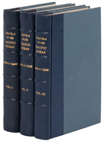
Title: Travels to the Source of the Missouri River and Across the American Continent to the Pacific Ocean. Performed by Order of the Government of the United States, in the Years 1804, 1805, and 1806... Published from the Official Report, and illustrated by a map of the route, and other maps Author: Lewis, Meriwether & William Clark Place: London Publisher: Printed for Longman, Hurst, Rees, Orme, and Brown Date: 1814 Description: xxiv, 663, [1 ad] pp. With a large folding copper-engraved map & 5 copper-engraved charts/plans on 3 sheets. (4to) 27x21 cm (10¾x8¼"), early half calf & marbled boards, rebacked with original gilt-tooled spine strip employed, endpapers renewed at the time of rebacking. First English Edition. First English edition of the official account of the most famous and most important expedition of exploration in U.S. history, a monumental undertaking executed with unbelievable skill and bravery. Derived from the journals of Lewis and Clark and other members of the expedition, the work is a rich mine of new information about a previously unexplored region. The folding map, "A Map of Lewis and Clark's Track Across the Western Portion of North America, from the Mississippi to the Pacific, by Order of the Executive of the United States in 1804, 5 & 6," Wheat, Transmississippi 317, is a close copy of the map in the American first edition of 1814. Bookplate of Humphery Willyams and printed shelf label: D:2, on front pastedown. Provenance: Sotheby's 9/21/84 References: Field 929; Graff 2480; Howes L317; Streeter 3128; Wagner-Camp 13:2; W-TW 317 for map. Lot Amendments Condition: Scuffing to boards; crease to half-title, a few fairly minor ill-creases to the large map, light foxing to the small maps but not the large one; very good or better. Item number: 266918
Title: Travels to the Source of the Missouri River and Across the American Continent to the Pacific Ocean. Performed by Order of the Government of the United States, in the Years 1804, 1805, and 1806... Published from the Official Report, and illustrated by a map of the route, and other maps Author: Lewis, Meriwether & William Clark Place: London Publisher: Printed for Longman, Hurst, Rees, Orme, and Brown Date: 1814 Description: xxiv, 663, [1 ad] pp. With a large folding copper-engraved map & 5 copper-engraved charts/plans on 3 sheets. (4to) 27x21 cm (10¾x8¼"), early half calf & marbled boards, rebacked with original gilt-tooled spine strip employed, endpapers renewed at the time of rebacking. First English Edition. First English edition of the official account of the most famous and most important expedition of exploration in U.S. history, a monumental undertaking executed with unbelievable skill and bravery. Derived from the journals of Lewis and Clark and other members of the expedition, the work is a rich mine of new information about a previously unexplored region. The folding map, "A Map of Lewis and Clark's Track Across the Western Portion of North America, from the Mississippi to the Pacific, by Order of the Executive of the United States in 1804, 5 & 6," Wheat, Transmississippi 317, is a close copy of the map in the American first edition of 1814. Bookplate of Humphery Willyams and printed shelf label: D:2, on front pastedown. Provenance: Sotheby's 9/21/84 References: Field 929; Graff 2480; Howes L317; Streeter 3128; Wagner-Camp 13:2; W-TW 317 for map. Lot Amendments Condition: Scuffing to boards; crease to half-title, a few fairly minor ill-creases to the large map, light foxing to the small maps but not the large one; very good or better. Item number: 266918


Try LotSearch and its premium features for 7 days - without any costs!
Be notified automatically about new items in upcoming auctions.
Create an alert