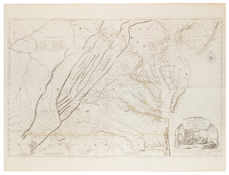
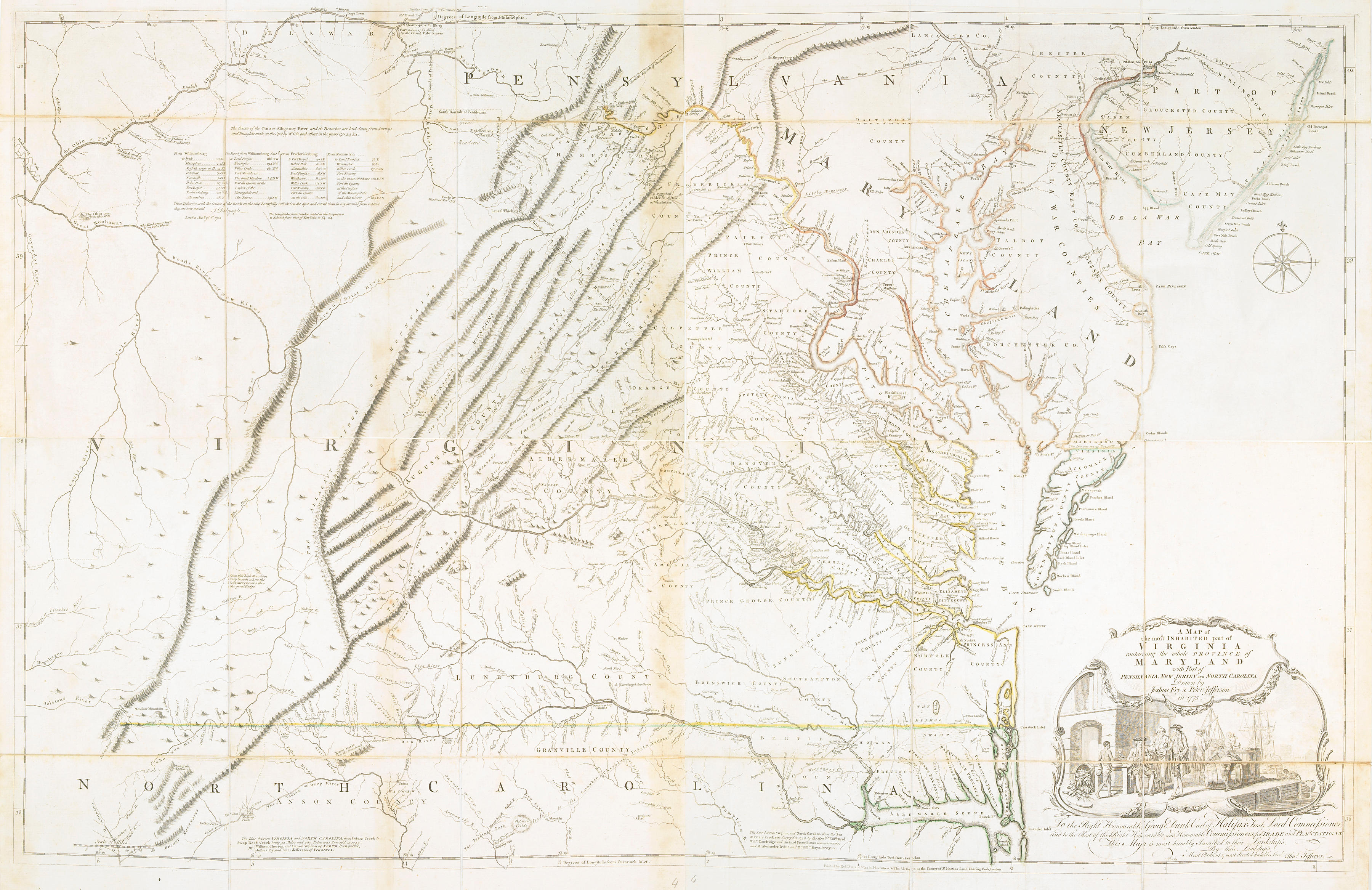
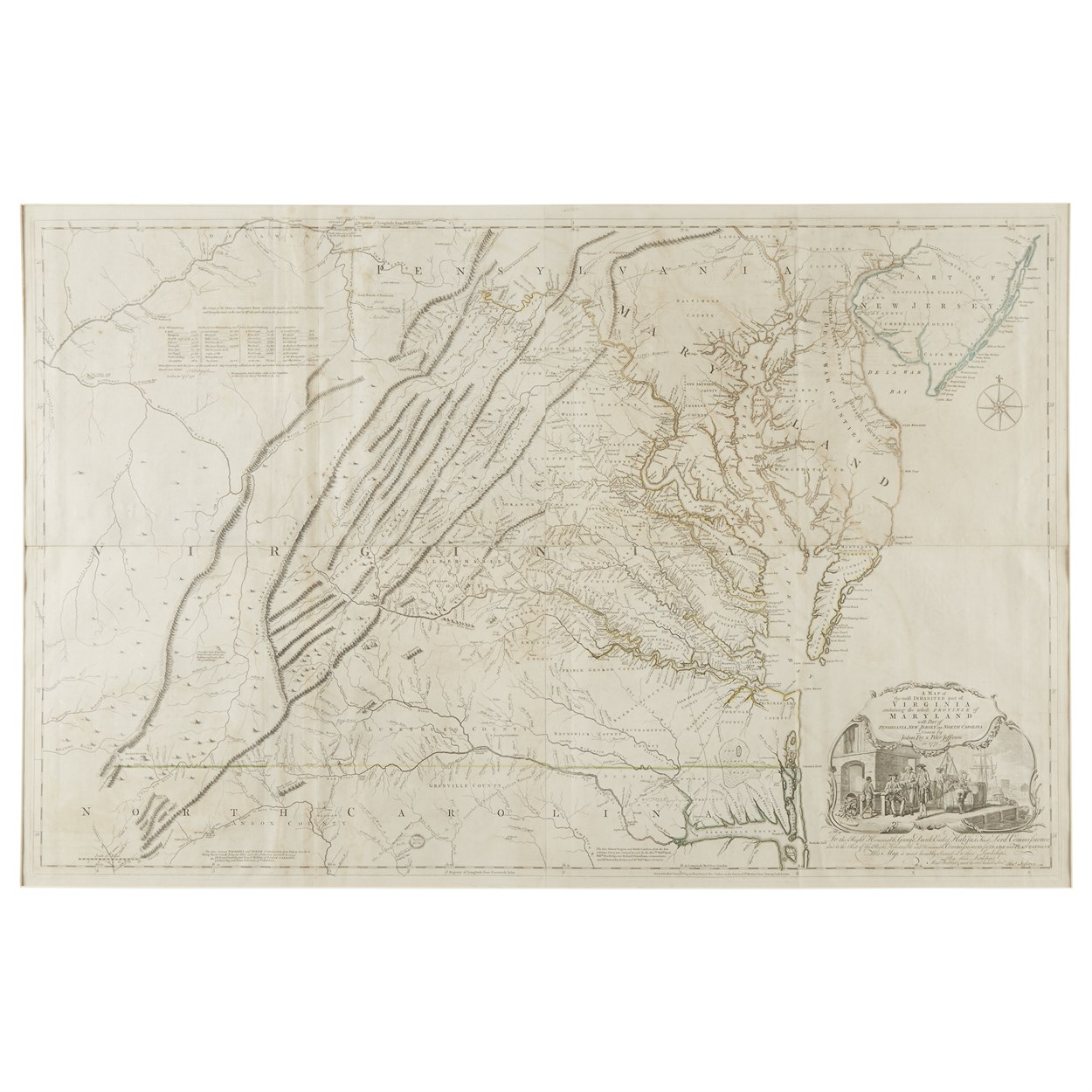
VIRGINIA]. FRY, Joshua and Peter JEFFERSON, cartographers. A Map of the Most Inhabited Part of Virginia.containing the whole Province of Maryland with Part of Pennsilvania, New Jersey and North Carolina, Drawn by Joshua Fry and Peter Jefferson in 1755. London: Printed for Robert Sayer and Thomas Jeffreys, [1775]. 4 engraved sheets, neatly joined in pairs to form two oblong sections, together approximately 860 x 1250mm., matted and in two matching giltwood frames (unexamined out of frames). Neatly hand-colored in outline in green and yellow, large engraved cartouche at right of one section, featuring an elaborate Virginia wharf scene: sailing vessels being unloaded by slaves, barrels (one containing tobacco plants) on the quay, two well-dressed gentlemen haggling and smoking; engraved dedication from Jeffreys (the publisher) to the Earl of Halifax, President of the Board of Trade and Plantations. THE MOST ELABORATE AND IMPORTANT MAP OF VIRGINIA FROM THE COLONIAL ERA. An exceptional early American map, based on careful surveys by Fry and Jefferson (the father of the future President), accurately delineating the boundaries of the colony and incorporating considerable new geographical information-- especially in the almost unexplored mountainous west--from early travelers including George Washington, Christopher Gist and John Dalrymple. First published in 1755, the map was corrected and revised at least 8 times in the course of the 18th century. This very fine example represents the Sixth state, published in 1775. Cumming, The Southeast in Early Maps , no.281; Pritchard & Taliaferro, Degrees of Latitude , no.30; Schwartz & Ehrenberg, Mapping of America , p.158.
VIRGINIA]. FRY, Joshua and Peter JEFFERSON, cartographers. A Map of the Most Inhabited Part of Virginia.containing the whole Province of Maryland with Part of Pennsilvania, New Jersey and North Carolina, Drawn by Joshua Fry and Peter Jefferson in 1755. London: Printed for Robert Sayer and Thomas Jeffreys, [1775]. 4 engraved sheets, neatly joined in pairs to form two oblong sections, together approximately 860 x 1250mm., matted and in two matching giltwood frames (unexamined out of frames). Neatly hand-colored in outline in green and yellow, large engraved cartouche at right of one section, featuring an elaborate Virginia wharf scene: sailing vessels being unloaded by slaves, barrels (one containing tobacco plants) on the quay, two well-dressed gentlemen haggling and smoking; engraved dedication from Jeffreys (the publisher) to the Earl of Halifax, President of the Board of Trade and Plantations. THE MOST ELABORATE AND IMPORTANT MAP OF VIRGINIA FROM THE COLONIAL ERA. An exceptional early American map, based on careful surveys by Fry and Jefferson (the father of the future President), accurately delineating the boundaries of the colony and incorporating considerable new geographical information-- especially in the almost unexplored mountainous west--from early travelers including George Washington, Christopher Gist and John Dalrymple. First published in 1755, the map was corrected and revised at least 8 times in the course of the 18th century. This very fine example represents the Sixth state, published in 1775. Cumming, The Southeast in Early Maps , no.281; Pritchard & Taliaferro, Degrees of Latitude , no.30; Schwartz & Ehrenberg, Mapping of America , p.158.


.jpg)

.jpg)


Try LotSearch and its premium features for 7 days - without any costs!
Be notified automatically about new items in upcoming auctions.
Create an alert