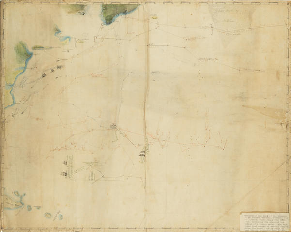
WESTERN SEABOARD OF THE BLACK SEA – [BUDISHCHEV, Ivan Matveevich (d.1828). Planar map of part of the Black Sea, the Sea of Marmora, and Constantinople , c.1801.] Manuscript map in pen and ink and watercolour, on paper watermarked 'D Blauw', 968 x 364mm, covering approximately 450 miles of the western coastline of the Black Sea from Odessa in the north to Istanbul and the Sea of Marmora in the south, drawn to an approximate scale of 57/8 inches to one degree of latitude (1:744,143), with soundings, explanatory text and toponymns in Russian, stylized mountains and cities, folded. (Western edge stained in places with associated fraying and loss just into image.)
WESTERN SEABOARD OF THE BLACK SEA – [BUDISHCHEV, Ivan Matveevich (d.1828). Planar map of part of the Black Sea, the Sea of Marmora, and Constantinople , c.1801.] Manuscript map in pen and ink and watercolour, on paper watermarked 'D Blauw', 968 x 364mm, covering approximately 450 miles of the western coastline of the Black Sea from Odessa in the north to Istanbul and the Sea of Marmora in the south, drawn to an approximate scale of 57/8 inches to one degree of latitude (1:744,143), with soundings, explanatory text and toponymns in Russian, stylized mountains and cities, folded. (Western edge stained in places with associated fraying and loss just into image.) In 1792-1809 Budischev served on the ships of the Baltic and Black Sea Russian Navy. From 1797-1799 he took part in a reconnaissance of the Black Sea northern coasts and of the Kuban River lower reaches. Later, in 1801-1802, he surveyed the western sea coast from Odessa to the Bosporus, which the present lot illustrates. The map is possibly the one Budischev made on completion of this voyage. Subsequently promoted, Budischev continued his hydrographic work and also ran the naval library of Black Sea charts. 'During this period, drew up an “Atlas of the Charts and Plans of part of the Black Sea” (1807) and the “Azov and Black Seas Marine Guide-book” ( Black Sea Encyclopaedia , p.156).
.jpg)


Try LotSearch and its premium features for 7 days - without any costs!
Be notified automatically about new items in upcoming auctions.
Create an alert