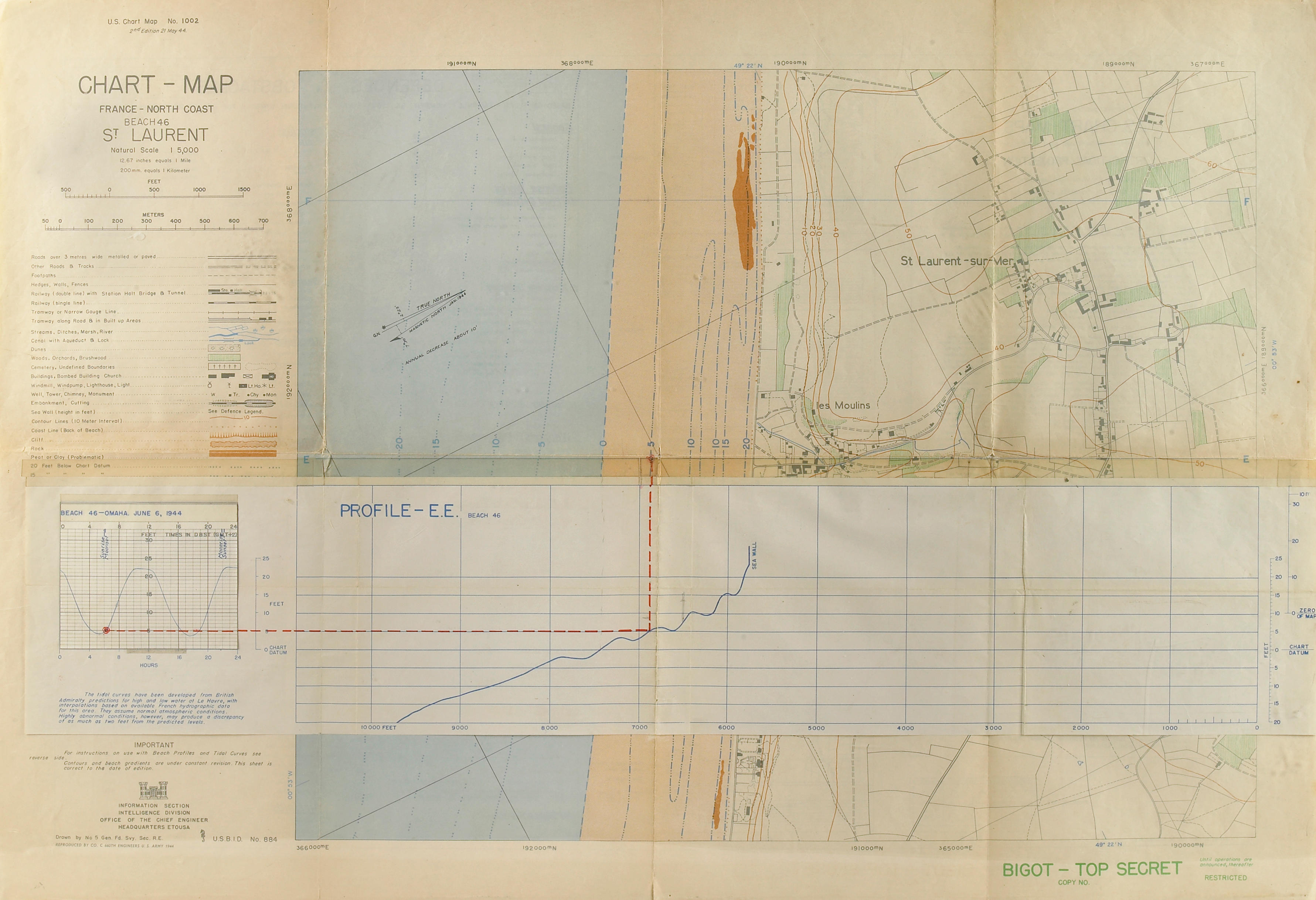
Utah Beach - North (Ravenoville). Second Beach Obstacle Overprint - Information as of 30 May. At bottom "Top Secret - bigot Until Departure for Combat Operations - then this sheet becomes Restricted." Framed, double-glazed so both sides are visible. 24.25 x 19.5 in. (sight). Top 2/3 or so is a plan view of the southern half of the beach, just about 6000 yards of it. The later information notes additional beach and land obstacles, such as fishnets, hedgehogs, tetrahedrons, anti-tank ditches, and mine fields. Extensive legends mark tidal or mud flats, marsh land, trees, orchards, hedges, dunes, gravel, cliffs, slopes, rocky cliffs, etc. Below the plan view is a panoramic photographic view - as the Navy pilots of the landing craft would see it, with landmarks noted. However, in the legend of the map is a note to Coxswains or Navigators: "Building landmarks, especially near the beach, may be destroys any craft land. Terrain features, therefore, are much more reliable for visual navigation from panoramic shoreline sketch above.... Also on reverse side are Sunlight and Moonlight Table, data on Inshore Currents and Tidal Stages." More evidence of the detailed planning that went into the Normandy invasion in the summer of 1944. This copy has a waterstain along the upper right margin and lower right margin, possibly indicating field use. Condition: Not removed from frame for examination.
Utah Beach - North (Ravenoville). Second Beach Obstacle Overprint - Information as of 30 May. At bottom "Top Secret - bigot Until Departure for Combat Operations - then this sheet becomes Restricted." Framed, double-glazed so both sides are visible. 24.25 x 19.5 in. (sight). Top 2/3 or so is a plan view of the southern half of the beach, just about 6000 yards of it. The later information notes additional beach and land obstacles, such as fishnets, hedgehogs, tetrahedrons, anti-tank ditches, and mine fields. Extensive legends mark tidal or mud flats, marsh land, trees, orchards, hedges, dunes, gravel, cliffs, slopes, rocky cliffs, etc. Below the plan view is a panoramic photographic view - as the Navy pilots of the landing craft would see it, with landmarks noted. However, in the legend of the map is a note to Coxswains or Navigators: "Building landmarks, especially near the beach, may be destroys any craft land. Terrain features, therefore, are much more reliable for visual navigation from panoramic shoreline sketch above.... Also on reverse side are Sunlight and Moonlight Table, data on Inshore Currents and Tidal Stages." More evidence of the detailed planning that went into the Normandy invasion in the summer of 1944. This copy has a waterstain along the upper right margin and lower right margin, possibly indicating field use. Condition: Not removed from frame for examination.


Try LotSearch and its premium features for 7 days - without any costs!
Be notified automatically about new items in upcoming auctions.
Create an alert