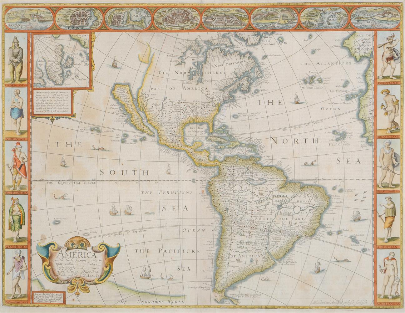
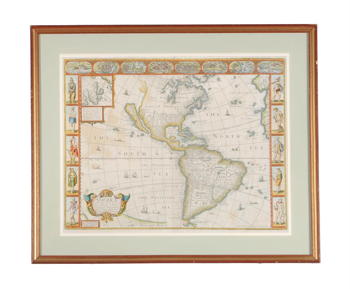
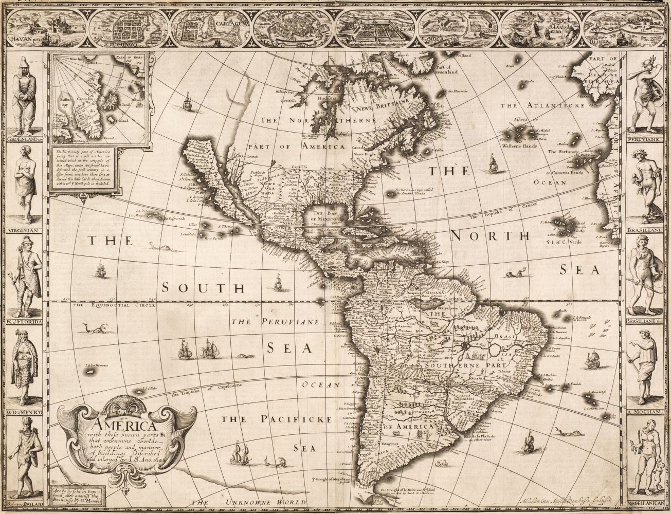
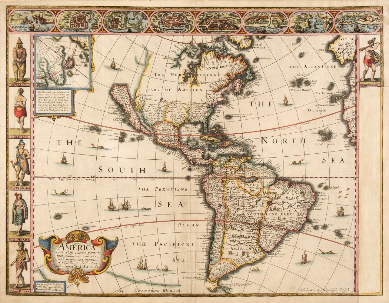
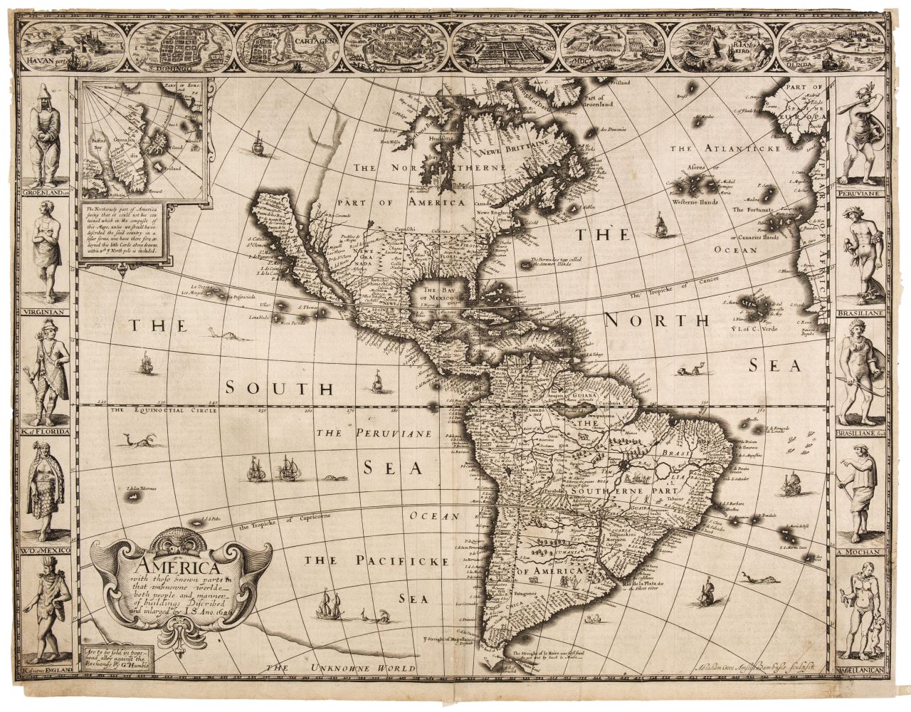
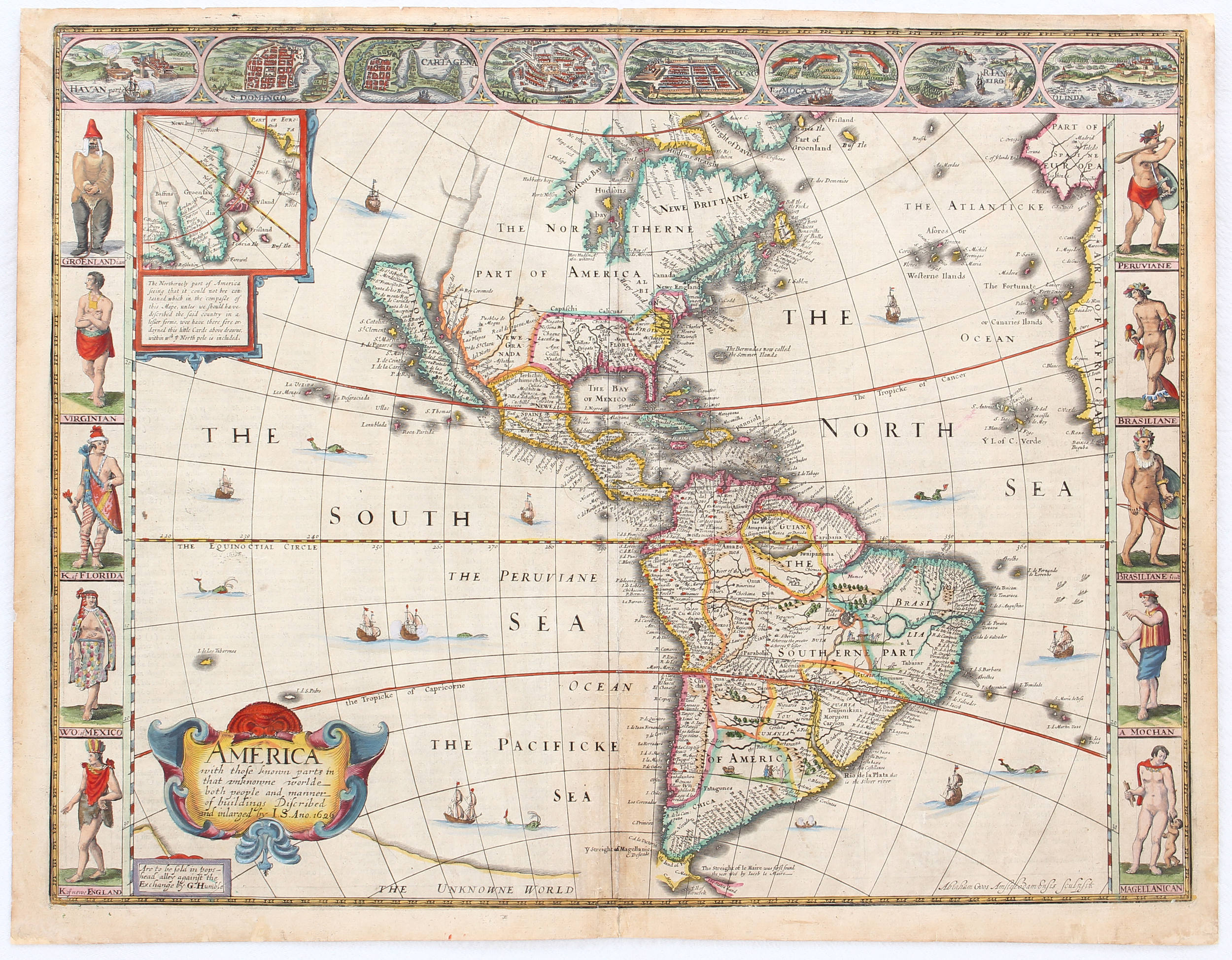
America, with those known parts in that unknowne worlde both people and manner of buildings Described and inlarged by I.S. Ano. 1626 Author: Speed, John Place: London Publisher: Thomas Bassett & Richard Chiswell Date: 1626-[1676] Description: Copper-engraved map, hand-colored; engraved by Abraham Goos. 39.2x51.2 cm. (15½x20¼"), including pictorial side and top borders with vignettes of people and places. John Speed's North and South America, when first issued in 1627, was the first English map of the Western Hemisphere, and the first map published in an atlas to depict California as an island, and an accurate east coast of North America, particularly between Chesapeake Bay and Cape Cod. Dated 1626 in the plate, the map was published in 1627 in Speed's "Theatre of the Empire of Great Britaine", the plates of which passed through several hands, and were used to print several editions, before being purchased by Thomas Bassett and Richard Chiswell, who produced the 1676 edition. Burden remarks, "[Abraham] Goos drew on his engraving of North America in 1624, and the Briggs 1625, to depict California as an island once again. He was the only Dutch cartographer to do so for some considerable time. There are five fewer place names than the Briggs. However, like his earlier one he includes a similar faint northwest coastline and Strait of Anian. Brasil and Frisland, remnants from the sixteenth century, make a stubborn appearance in the North Atlantic. The fledgling colonies of Plymouth in New England and Iames Citti in Virginia, are both recognized. Decorating the whole are three attractive borders. The two sides illustrate the natives of the continent, the left bears those of the north, the right those of the south..." In the 1662 issue of the map, there were a number of cartographic additions, including Boston, Conectacut, Long Ile, Mary land, and Carolina. The vignettes at the top include views of Havana, S. Domingo, Cartagena, Mexico City, Cusco, etc. Several of the natives are unclothed, and anatomically correct. The coloring on the present map is old but not original. English text on verso. Burden 217; Leighly 6; McLaughlin 3; Tooley 5. With receipt indicating the map was purchased from Jonathan Potter in 2004. Lot Amendments Condition: Some toning and light foxing, expert repairs in margins which also display some soiling; remains of mounting tape on verso at top edge; very good. Item number: 316695
America, with those known parts in that unknowne worlde both people and manner of buildings Described and inlarged by I.S. Ano. 1626 Author: Speed, John Place: London Publisher: Thomas Bassett & Richard Chiswell Date: 1626-[1676] Description: Copper-engraved map, hand-colored; engraved by Abraham Goos. 39.2x51.2 cm. (15½x20¼"), including pictorial side and top borders with vignettes of people and places. John Speed's North and South America, when first issued in 1627, was the first English map of the Western Hemisphere, and the first map published in an atlas to depict California as an island, and an accurate east coast of North America, particularly between Chesapeake Bay and Cape Cod. Dated 1626 in the plate, the map was published in 1627 in Speed's "Theatre of the Empire of Great Britaine", the plates of which passed through several hands, and were used to print several editions, before being purchased by Thomas Bassett and Richard Chiswell, who produced the 1676 edition. Burden remarks, "[Abraham] Goos drew on his engraving of North America in 1624, and the Briggs 1625, to depict California as an island once again. He was the only Dutch cartographer to do so for some considerable time. There are five fewer place names than the Briggs. However, like his earlier one he includes a similar faint northwest coastline and Strait of Anian. Brasil and Frisland, remnants from the sixteenth century, make a stubborn appearance in the North Atlantic. The fledgling colonies of Plymouth in New England and Iames Citti in Virginia, are both recognized. Decorating the whole are three attractive borders. The two sides illustrate the natives of the continent, the left bears those of the north, the right those of the south..." In the 1662 issue of the map, there were a number of cartographic additions, including Boston, Conectacut, Long Ile, Mary land, and Carolina. The vignettes at the top include views of Havana, S. Domingo, Cartagena, Mexico City, Cusco, etc. Several of the natives are unclothed, and anatomically correct. The coloring on the present map is old but not original. English text on verso. Burden 217; Leighly 6; McLaughlin 3; Tooley 5. With receipt indicating the map was purchased from Jonathan Potter in 2004. Lot Amendments Condition: Some toning and light foxing, expert repairs in margins which also display some soiling; remains of mounting tape on verso at top edge; very good. Item number: 316695






Try LotSearch and its premium features for 7 days - without any costs!
Be notified automatically about new items in upcoming auctions.
Create an alert