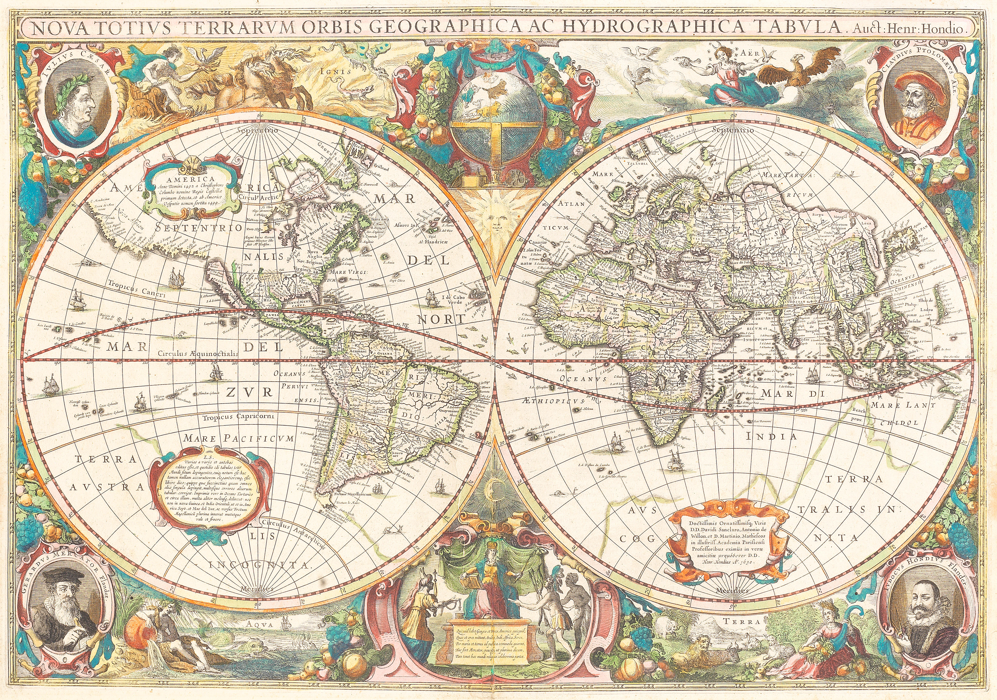
Henricus Hondius Nova totius terrarum orbis geographica ac hydrographia tabula. Amsterdam, 1641 [or later] 505 x 610mm., double-page engraved twin-hemispherical world map, borders densely decorated with allegories of the elements. corner medallion portraits of Julius Caesar Ptolemy, Mercator and Hondius, Latin text on verso A dark impression of "a fine ornate example of the decorative cartography of the period" (Shirley). This is a famous baroque-style map of the world, first added to the revitalised Mercator-Hondius Atlas in 1633. The vignette portraits of Ptolemy, Mercator and Jodocus Hondius symbolically link the Hondius family to the two greatest cartographers in early history; the border scenes are allegories of the four classical elements - earth, air, fire and water - while figures representing the continents of Asia, Africa and America bring tribute to Europe, depicted as a queen enthroned. Geographically, the map is typical of the period, with California shown as an island, North America without the Great Lakes, and a large Terra Australis Incognita. However, this is regarded as "the oldest dated map in an atlas on which a Dutch discovery in Australia has been shown cartographically" (Schilder), with a short extent of the northern coast of Australia, discovered by Carstensz. and Colsten in 1623, visible to the south of New Guinea. LITERATURE: Shirley 336, state 2Condition reportGood condition The lot is sold in the condition it is in at the time of sale. The
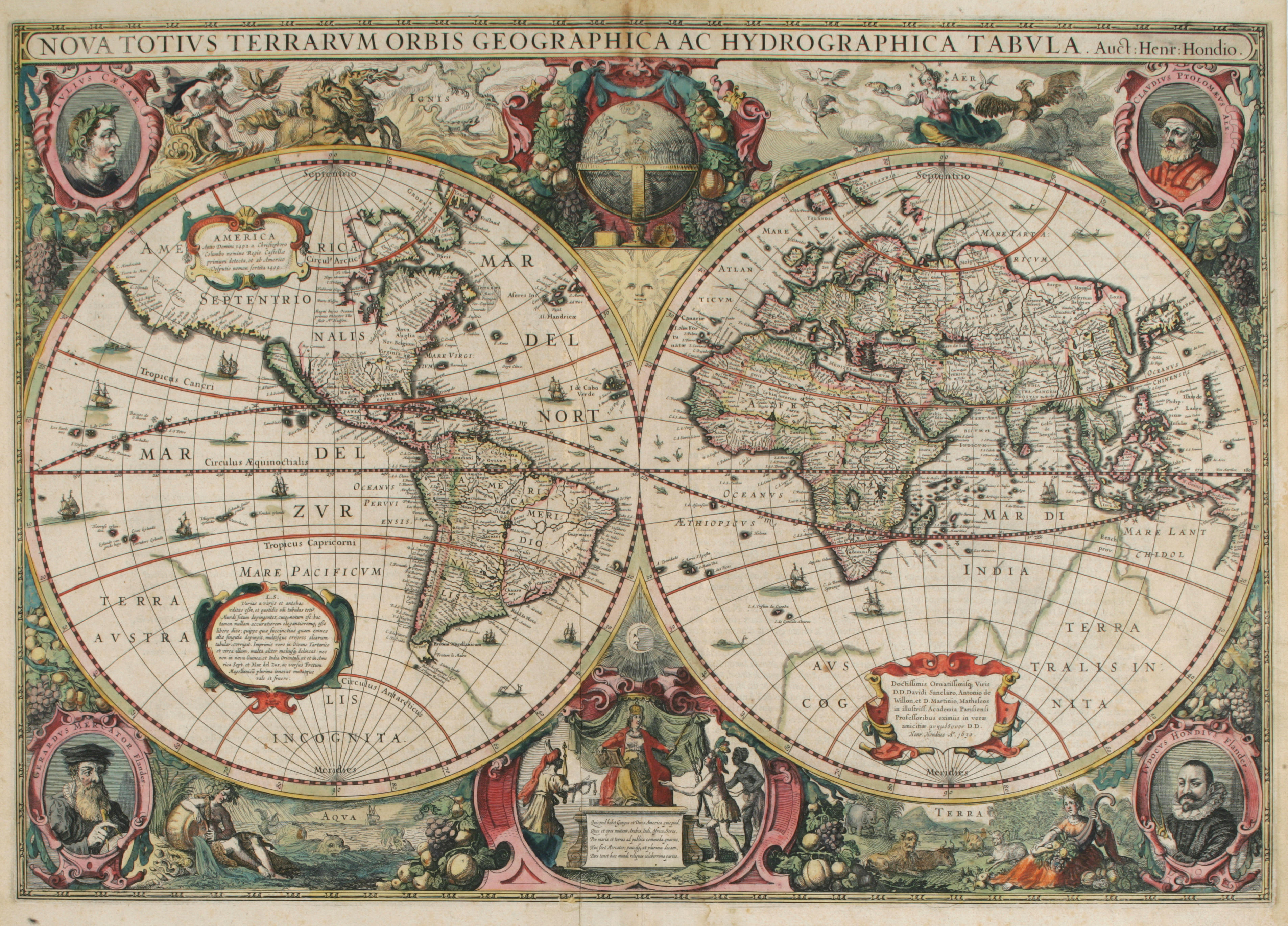
Henricus Hondius Nova totius terrarum orbis geographica ac hydrographia tabula. Amsterdam, 1641 [or later] 505 x 610mm., double-page engraved twin-hemispherical world map, borders densely decorated with allegories of the elements. corner medallion portraits of Julius Caesar Ptolemy, Mercator and Hondius, Latin text on verso A dark impression of "a fine ornate example of the decorative cartography of the period" (Shirley). This is a famous baroque-style map of the world, first added to the revitalised Mercator-Hondius Atlas in 1633. The vignette portraits of Ptolemy, Mercator and Jodocus Hondius symbolically link the Hondius family to the two greatest cartographers in early history; the border scenes are allegories of the four classical elements - earth, air, fire and water - while figures representing the continents of Asia, Africa and America bring tribute to Europe, depicted as a queen enthroned. Geographically, the map is typical of the period, with California shown as an island, North America without the Great Lakes, and a large Terra Australis Incognita. However, this is regarded as "the oldest dated map in an atlas on which a Dutch discovery in Australia has been shown cartographically" (Schilder), with a short extent of the northern coast of Australia, discovered by Carstensz. and Colsten in 1623, visible to the south of New Guinea. LITERATURE: Shirley 336, state 2Condition reportGood condition The lot is sold in the condition it is in at the time of sale. The


.jpg)
Try LotSearch and its premium features for 7 days - without any costs!
Be notified automatically about new items in upcoming auctions.
Create an alert