Joan Blaeu
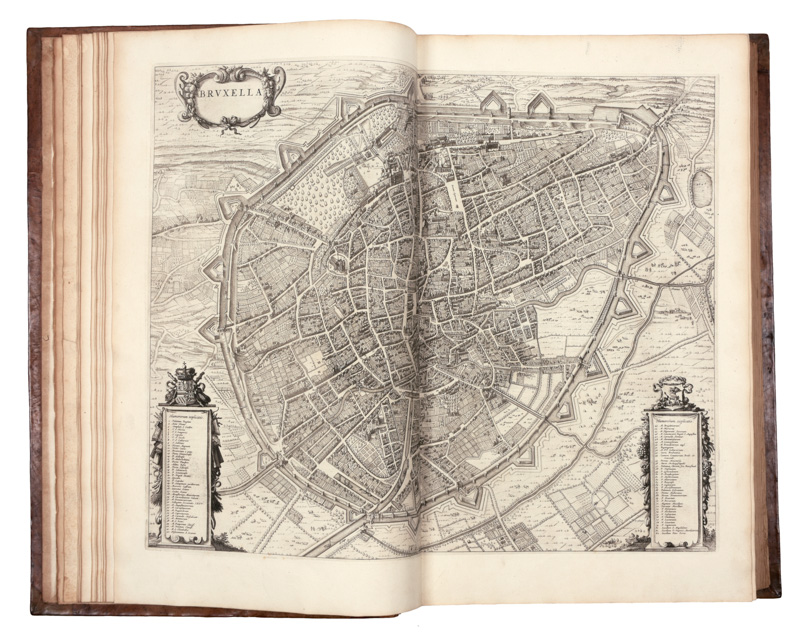
Novum ac magnum theatrum urbium Belgicae regiae, ad praesentis temporis faciem expressum a Joanne Blaeu. Amsterdam: Joan Blaeu, [27 September] 1649
Folio (570 x 355 mm.), printed title withing engraved armorial frame, 147 engraved plates, comprising 8 in the text (one double-page), 4 full-page, one folding map, 134 double-page plates (56 with four images, one with three, 12 with two, and 63 with one), ALL FINELY COLOURED BY A CONTEMPORARY HAND, contemporary Dutch vellum gilt, floral roll frame, leafy floral cornerpieces and large central lozenge, spine gilt in compartments with central palmette, blue morocco label, yapp edges, occasional browning, slight wear to binding
A beautifully hand-coloured copy of Blaeu’s atlas showing the region of the Low Countries—comprising territory that is now Belgium—left under the control of the Spanish crown after the Peace of Munster ended the Dutch War of Independence (1568-1648).
A companion volume featuring the towns of the new Dutch Republic (“Urbium Belgicae Foederatae”) was issued simultaneously with this volume, but the two atlases are often found separately.
In his bibliography of the great Dutch atlases, Koeman says that “of all the Blaeu atlases, the townbooks of the Netherlands are held in the highest esteem in the Netherlands,” and van der Krogt says that the maps “show the proud and industrious cities of the North in their full splendour.” Our third edition in Latin, published at the same time as the first edition in Dutch, is especially valued because its maps reflect changes in the political situation that occurred after the publication of the first and second editions earlier in the year; and it contains four additional engravings included here for the first time. These show views and plans of Thérouanne (Tarvenna) and a plan of Aire (Aria), and the detailed maps of the towns of Gulich and Lingen (Linga). The mostly double-page engravings comprise topographical maps, city plans, and views of the towns, with all three sometimes combined, via vignettes and insets, into the same engraving.
Joan [or Johannes] Blaeu (1596-1673) and his father Willem (1571-1638) were major figures in the golden age of the Dutch/Netherlandish School of cartography in the 16th and 17thcenturies. Joan served as the official cartographer of the Dutch East India Company, then the leading player in global trade.
REFERENCES: Koeman I, 67.
PROVENANCE: Edward Harley, 2nd Earl of Oxford and Earl Mortimer (1769-1841, Member of Parliament and bibliophile), engraved armorial bookplate dated 1714 on verso of title, small reproduction of a portrait of Harley’s father, the Earl of Oxford and Mortimer, pasted below it; Clement Ferguson, book label on verso of dedication and rear pastedown (along with a nineteenth-century map of the Low Countries


.jpg)

.jpg)
Try LotSearch and its premium features for 7 days - without any costs!
Be notified automatically about new items in upcoming auctions.
Create an alert