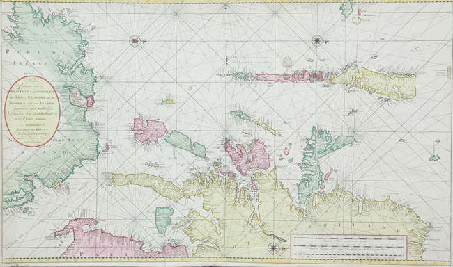
KEULEN, Gerard van (1678-1726). Het Eyland Ysland in 't Groot . [Amsterdam: c.1720]. Very rare and attractive map of Iceland, with contemporary hand colouring. Unusually, the cartographic basis is the map of Iceland by Joris Carolus, not other sea charts by the Van Keulens, although it was destined for inclusion in their Zee-Fakkel . The chart is extremely scarce: we can only trace 2 copies selling at auction in the past 40 years (ABPC/RBH). Koeman IV, Nr. 226 (there is a variant with coastal profiles printed on a separate plate to the right-hand side, not present here, under Koeman 226*; Tooley Scandinavia 396 (dating the map 1728). Double-page engraved map, coloured by a contemporary hand , verso blank, 2 compass roses in the sea and one in the centre of Iceland, rhumb lines, title within the sea area at top, scale cartouche to bottom left, 511 x 620mm (plate mark), 533 x 652mm (sheet).
KEULEN, Gerard van (1678-1726). Het Eyland Ysland in 't Groot . [Amsterdam: c.1720]. Very rare and attractive map of Iceland, with contemporary hand colouring. Unusually, the cartographic basis is the map of Iceland by Joris Carolus, not other sea charts by the Van Keulens, although it was destined for inclusion in their Zee-Fakkel . The chart is extremely scarce: we can only trace 2 copies selling at auction in the past 40 years (ABPC/RBH). Koeman IV, Nr. 226 (there is a variant with coastal profiles printed on a separate plate to the right-hand side, not present here, under Koeman 226*; Tooley Scandinavia 396 (dating the map 1728). Double-page engraved map, coloured by a contemporary hand , verso blank, 2 compass roses in the sea and one in the centre of Iceland, rhumb lines, title within the sea area at top, scale cartouche to bottom left, 511 x 620mm (plate mark), 533 x 652mm (sheet).
.jpg?w=400?width=1600&quality=70)
.jpg?w=400?width=1600&quality=70)
.jpg)




Try LotSearch and its premium features for 7 days - without any costs!
Be notified automatically about new items in upcoming auctions.
Create an alert