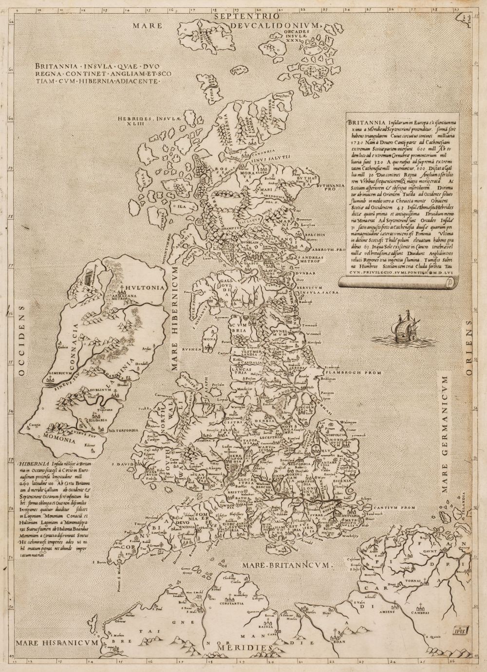
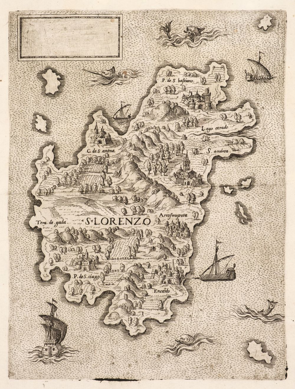
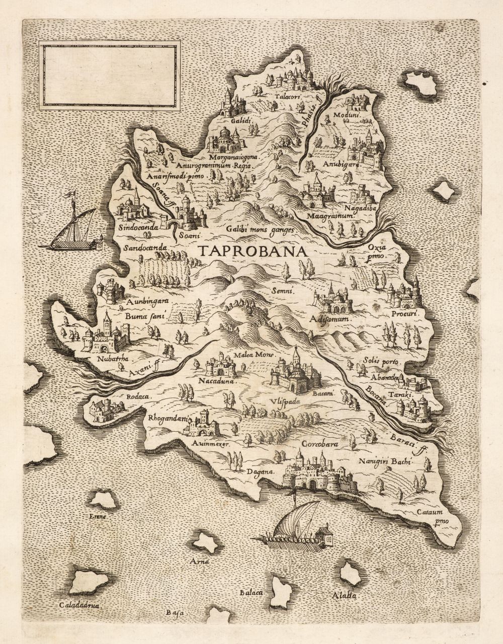
[Lafreri, Antonio] UNTITLED COMPOSITE ATLAS. [ROME, C.1565] LARGE FOLIO (453 X 335MM.), 46 ENGRAVED MAPS, MOST INLAID, VARIOUS DATES, CONTEMPORARY VELLUM, MANY MAPS STAINED OR CREASED, SOME MAPS SPLIT AT JOINS, BINDING VERY WORN (FOR FULL DESCRIPTION OF CONDITION REFER TO DEPARTMENT) The mid-sixteenth century was a golden age for Italian cartography, as a disparate group of mapmakers, engravers and publishers from the two centres of Venice and Rome dominated European map publishing. The output of this group is generally given the umbrella term "Lafreri map" or "Lafreri atlas" from the Rome publisher Antonio Lafreri; however, this is to exaggerate the importance of Lafreri, who was really a printseller and retailer rather than a mapmaker. Rather, the two leading figures were Giacomo Gastaldi, the great cartographer of the period, and Paolo Forlani, the leading engraver/mapmaker of the day, both of whom worked in Venice. Italian maps of the period were sold separately, so there is no uniformity of size or style, but latterly buyers started to have the maps bound. The lack of uniformity caused problems, as some maps had to be folded to fit; for ease, the binders tended to trim the maps to their engraved border and inlay them - adding additional paper margins to create a uniform book block. Where Lafreri is important is that he was the only retailer to add an engraved title-page to such collection - hence the term "Lafreri atlas". These are the earliest modern world "atlases" and so very important in the history of European cartography. Most extant atlases seem to have originated in Venice but, unusually, the core of this atlas is formed of Rome imprints and it may well be that the atlas was assembled by Lafreri himself in about 1565 (judging from the imprints), supplemented with Venetian maps not reflected in his own stock - notably Gastaldi's important maps of Italy, Arabia and southern Asia (all with their letterpress gazetteers) and Forlani's South America, and some later insertions, notably Florimi's rare map of Terre Promissionis. This compilation is also relatively early as the majority of extant datable atlases are from 1568 onwards. The maps in this atlas comprise: 1. [LILY, George] Britanniæ Insulæ qvæ Nunc Angliæ et Scotiæ Regna continent cum Hibernia Adiacente nova Descriptio. [Rome:] Sebastiano di Re 1558, 400 x 545mm., inlaid Tooley, Maps In Italian Atlases, 271; Shirley, British Isles, I, 63 (pl.32) 2. SALAMANCA, Antonio. [Untitled map of the world on a double cordiform projection]. Rome: Antonio Lafreri, [c.1564], 325 x 515mm., inlaid Shirley, Mapping Of The World, 91; Tooley, Maps In Italian Atlases, 2 3. [LAFRERI, Antonio] Hybernia nunc Irlant. [Rome, c.1560], 335 x 245mm. Tooley, Maps In Italian Atlases, 318 4. [DEVENTER, Jacob van] Gelriae Cliviae Iuliae nec non aliarum regionum adiacentium... Rome: Michele Tramezini, 1558, 500 x 385mm., inlaid Tooley, Maps In Italian Atlases, 232 5. [DEVENTER, Jacob van] Brabantiae Belgarvm Provinciae recens exactaqve descriptio... Rome: Michele Tramezini, 1558, 510 x 400mm., inlaid Tooley, Maps In Italian Atlases, 143; Karrow, Mapmakers, 25/1.2 6. LIGORIO, Pirro. Totius Galliæ Descriptio, cum parte Angliæ, Germaniæ, Flandriæ, Brabantiæ, Italiæ, Romam usque... Rome: Michele Tramezini, 1558, 390 x 515mm., inlaid Tooley, Maps In Italian Atlases, 208 7. [TSCHUDI, Aegidius. Untitled map of Switzerland] Iodoco à Meggen Lucernati Praetorianorum Praefecto Ant. Salamanca .S. Heluetios olim uir clariss. nunc Suiceros... Rome: Antonio Salamanca 1555, 440 x 610mm., wide margins Tooley, Maps In Italian Atlases, 534 8. [MERCATOR, Gerard] Flandriae recens exactaq, descriptio... Rome: Michele Tramezini, 1555, 385 x 515mm., inlaid Tooley, Maps In Italian Atlases, 198 9. [DEVENTER, Jacob van] Hollandiae Batavor. veteris insvlae et locorvm adiacentivm exacta descriptio... Rome: Michele Tramezini, 1558, 520 x 380mm., inlaid Tooley, Maps In Italian Atlases, 299 10. [BOILEAU DE BOUILLON, Gilles]
[Lafreri, Antonio] UNTITLED COMPOSITE ATLAS. [ROME, C.1565] LARGE FOLIO (453 X 335MM.), 46 ENGRAVED MAPS, MOST INLAID, VARIOUS DATES, CONTEMPORARY VELLUM, MANY MAPS STAINED OR CREASED, SOME MAPS SPLIT AT JOINS, BINDING VERY WORN (FOR FULL DESCRIPTION OF CONDITION REFER TO DEPARTMENT) The mid-sixteenth century was a golden age for Italian cartography, as a disparate group of mapmakers, engravers and publishers from the two centres of Venice and Rome dominated European map publishing. The output of this group is generally given the umbrella term "Lafreri map" or "Lafreri atlas" from the Rome publisher Antonio Lafreri; however, this is to exaggerate the importance of Lafreri, who was really a printseller and retailer rather than a mapmaker. Rather, the two leading figures were Giacomo Gastaldi, the great cartographer of the period, and Paolo Forlani, the leading engraver/mapmaker of the day, both of whom worked in Venice. Italian maps of the period were sold separately, so there is no uniformity of size or style, but latterly buyers started to have the maps bound. The lack of uniformity caused problems, as some maps had to be folded to fit; for ease, the binders tended to trim the maps to their engraved border and inlay them - adding additional paper margins to create a uniform book block. Where Lafreri is important is that he was the only retailer to add an engraved title-page to such collection - hence the term "Lafreri atlas". These are the earliest modern world "atlases" and so very important in the history of European cartography. Most extant atlases seem to have originated in Venice but, unusually, the core of this atlas is formed of Rome imprints and it may well be that the atlas was assembled by Lafreri himself in about 1565 (judging from the imprints), supplemented with Venetian maps not reflected in his own stock - notably Gastaldi's important maps of Italy, Arabia and southern Asia (all with their letterpress gazetteers) and Forlani's South America, and some later insertions, notably Florimi's rare map of Terre Promissionis. This compilation is also relatively early as the majority of extant datable atlases are from 1568 onwards. The maps in this atlas comprise: 1. [LILY, George] Britanniæ Insulæ qvæ Nunc Angliæ et Scotiæ Regna continent cum Hibernia Adiacente nova Descriptio. [Rome:] Sebastiano di Re 1558, 400 x 545mm., inlaid Tooley, Maps In Italian Atlases, 271; Shirley, British Isles, I, 63 (pl.32) 2. SALAMANCA, Antonio. [Untitled map of the world on a double cordiform projection]. Rome: Antonio Lafreri, [c.1564], 325 x 515mm., inlaid Shirley, Mapping Of The World, 91; Tooley, Maps In Italian Atlases, 2 3. [LAFRERI, Antonio] Hybernia nunc Irlant. [Rome, c.1560], 335 x 245mm. Tooley, Maps In Italian Atlases, 318 4. [DEVENTER, Jacob van] Gelriae Cliviae Iuliae nec non aliarum regionum adiacentium... Rome: Michele Tramezini, 1558, 500 x 385mm., inlaid Tooley, Maps In Italian Atlases, 232 5. [DEVENTER, Jacob van] Brabantiae Belgarvm Provinciae recens exactaqve descriptio... Rome: Michele Tramezini, 1558, 510 x 400mm., inlaid Tooley, Maps In Italian Atlases, 143; Karrow, Mapmakers, 25/1.2 6. LIGORIO, Pirro. Totius Galliæ Descriptio, cum parte Angliæ, Germaniæ, Flandriæ, Brabantiæ, Italiæ, Romam usque... Rome: Michele Tramezini, 1558, 390 x 515mm., inlaid Tooley, Maps In Italian Atlases, 208 7. [TSCHUDI, Aegidius. Untitled map of Switzerland] Iodoco à Meggen Lucernati Praetorianorum Praefecto Ant. Salamanca .S. Heluetios olim uir clariss. nunc Suiceros... Rome: Antonio Salamanca 1555, 440 x 610mm., wide margins Tooley, Maps In Italian Atlases, 534 8. [MERCATOR, Gerard] Flandriae recens exactaq, descriptio... Rome: Michele Tramezini, 1555, 385 x 515mm., inlaid Tooley, Maps In Italian Atlases, 198 9. [DEVENTER, Jacob van] Hollandiae Batavor. veteris insvlae et locorvm adiacentivm exacta descriptio... Rome: Michele Tramezini, 1558, 520 x 380mm., inlaid Tooley, Maps In Italian Atlases, 299 10. [BOILEAU DE BOUILLON, Gilles]


Try LotSearch and its premium features for 7 days - without any costs!
Be notified automatically about new items in upcoming auctions.
Create an alert