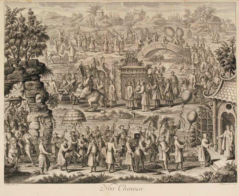
Title: Description Geographique, Historique, Chronologique, Politique et Physique de l'Empire de la Chine Author: Du Halde, Jean-Baptiste Place: Paris Publisher: P.G. Le Mercier Date: 1735 Description: 4 volumes. [4], viii, lii, iii, [1], 592; [4], iv, 725, [1]; [4], iv, 565, [2]; [4], ii, 520 pp. Title-pages printed in red & black; copper-engraved title-page vignettes; 5 engraved head-pieces and 5 engraved initials; a few woodcut illustrations and diagrams in text, woodcut initials, head- and tail-pieces & typographic ornaments. With 62 (of 65) copper-engraved maps, plans & plates, most folding. (folio) 42.5x26.5 cm. (16¾x10¾”), period mottled calf, spines tooled in gilt, raised bands, morocco lettering pieces, marbled endpapers. First Edition. First Edition of Du Halde's important description of China and the east, notable for the significant series of maps as well as the text and views. It was the most comprehensive survey of China printed in the eighteenth century, drawn from the accounts and surveys (both published and unpublished) of twenty-seven Jesuits. This encyclopaedic work not only provided valuable information on Chinese political institutions, education, language, medicine, science, customs and artifacts, but also included the first appearance of 43 maps by d'Anville. Drawn from recent surveys made by the Jesuits in China, these maps are considered by Tooley to be "the principal cartographic authority on China during the 18th century". The work also contains the first separate map of Korea, together with a previously unpublished account of that country by Jean-Baptiste Regis. There are maps of the various provinces and plans of their cities, and, notably, a 12-sheet map of Tartary, and a 10-sheet map of Tibet (a general map and 9 detail maps). This copy lacking the two general maps of China and the general map of Tartary, Lot Amendments Condition: Some wear to joints and extremities, occasional minor toning or offset to contents, but overall a superior copy save for the three missing maps, clean and sound. Item number: 243272
Title: Description Geographique, Historique, Chronologique, Politique et Physique de l'Empire de la Chine Author: Du Halde, Jean-Baptiste Place: Paris Publisher: P.G. Le Mercier Date: 1735 Description: 4 volumes. [4], viii, lii, iii, [1], 592; [4], iv, 725, [1]; [4], iv, 565, [2]; [4], ii, 520 pp. Title-pages printed in red & black; copper-engraved title-page vignettes; 5 engraved head-pieces and 5 engraved initials; a few woodcut illustrations and diagrams in text, woodcut initials, head- and tail-pieces & typographic ornaments. With 62 (of 65) copper-engraved maps, plans & plates, most folding. (folio) 42.5x26.5 cm. (16¾x10¾”), period mottled calf, spines tooled in gilt, raised bands, morocco lettering pieces, marbled endpapers. First Edition. First Edition of Du Halde's important description of China and the east, notable for the significant series of maps as well as the text and views. It was the most comprehensive survey of China printed in the eighteenth century, drawn from the accounts and surveys (both published and unpublished) of twenty-seven Jesuits. This encyclopaedic work not only provided valuable information on Chinese political institutions, education, language, medicine, science, customs and artifacts, but also included the first appearance of 43 maps by d'Anville. Drawn from recent surveys made by the Jesuits in China, these maps are considered by Tooley to be "the principal cartographic authority on China during the 18th century". The work also contains the first separate map of Korea, together with a previously unpublished account of that country by Jean-Baptiste Regis. There are maps of the various provinces and plans of their cities, and, notably, a 12-sheet map of Tartary, and a 10-sheet map of Tibet (a general map and 9 detail maps). This copy lacking the two general maps of China and the general map of Tartary, Lot Amendments Condition: Some wear to joints and extremities, occasional minor toning or offset to contents, but overall a superior copy save for the three missing maps, clean and sound. Item number: 243272


Try LotSearch and its premium features for 7 days - without any costs!
Be notified automatically about new items in upcoming auctions.
Create an alert