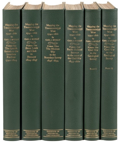
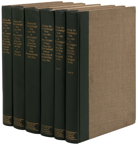
Mapping the Transmississippi West...1540-1861 Author: Wheat, Carl Irving Place: San Francisco Publisher: Institute for Historical Cartography Date: 1957-1963 Description: 8 vol. 5 volumes in 6, plus 2 supplemental works. Illustrated throughout with facsimile maps, many of which are folding; color frontispieces. 14x10, green cloth-backed beige cloth, spines lettered in gilt. One of 1000 sets, all designed by the Grabhorn Press. First Edition. The monumental and exceptionally thorough work detailing our expanding knowledge of the American West, unlikely to be surpassed. Vol. I was printed by the Grabhorn Press; Vols. 2-5 were printed by Taylor & Taylor & James Printing from the Grabhorn design. Vol. I: The Spanish Entrada to the Louisiana Purchase, 1540-1804; Vol. II: From Lewis and Clark to Fremont, 1804-1845; Vol. III: The Mexican War to the Boundary Survey, 1846-1854; Vol. IV: Pacific Railroad Surveys to the onset of the Civil War, 1855-1860; Vol. V Civil War to the Geological Survey. Provenance: The family of Carl I. Wheat. Supplemental volumes include: Seavey, Charles A. Mapping the Transmississippi West, 1540-1861: An Index to the Cartobibliography. Occasional Paper No. 3. Winnetka, IL: Speculum Orbis Press, 1992. Wheat, Carl I. Mapping the American West 1540-1857: A Preliminary Study. Worcester, MA: The Society, 1954. Lot Amendments Condition: Few very minor rubs to covers; about fine. Some minor toning to supplemental volumes. Item number: 315648
Mapping the Transmississippi West...1540-1861 Author: Wheat, Carl Irving Place: San Francisco Publisher: Institute for Historical Cartography Date: 1957-1963 Description: 8 vol. 5 volumes in 6, plus 2 supplemental works. Illustrated throughout with facsimile maps, many of which are folding; color frontispieces. 14x10, green cloth-backed beige cloth, spines lettered in gilt. One of 1000 sets, all designed by the Grabhorn Press. First Edition. The monumental and exceptionally thorough work detailing our expanding knowledge of the American West, unlikely to be surpassed. Vol. I was printed by the Grabhorn Press; Vols. 2-5 were printed by Taylor & Taylor & James Printing from the Grabhorn design. Vol. I: The Spanish Entrada to the Louisiana Purchase, 1540-1804; Vol. II: From Lewis and Clark to Fremont, 1804-1845; Vol. III: The Mexican War to the Boundary Survey, 1846-1854; Vol. IV: Pacific Railroad Surveys to the onset of the Civil War, 1855-1860; Vol. V Civil War to the Geological Survey. Provenance: The family of Carl I. Wheat. Supplemental volumes include: Seavey, Charles A. Mapping the Transmississippi West, 1540-1861: An Index to the Cartobibliography. Occasional Paper No. 3. Winnetka, IL: Speculum Orbis Press, 1992. Wheat, Carl I. Mapping the American West 1540-1857: A Preliminary Study. Worcester, MA: The Society, 1954. Lot Amendments Condition: Few very minor rubs to covers; about fine. Some minor toning to supplemental volumes. Item number: 315648


Try LotSearch and its premium features for 7 days - without any costs!
Be notified automatically about new items in upcoming auctions.
Create an alert