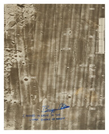
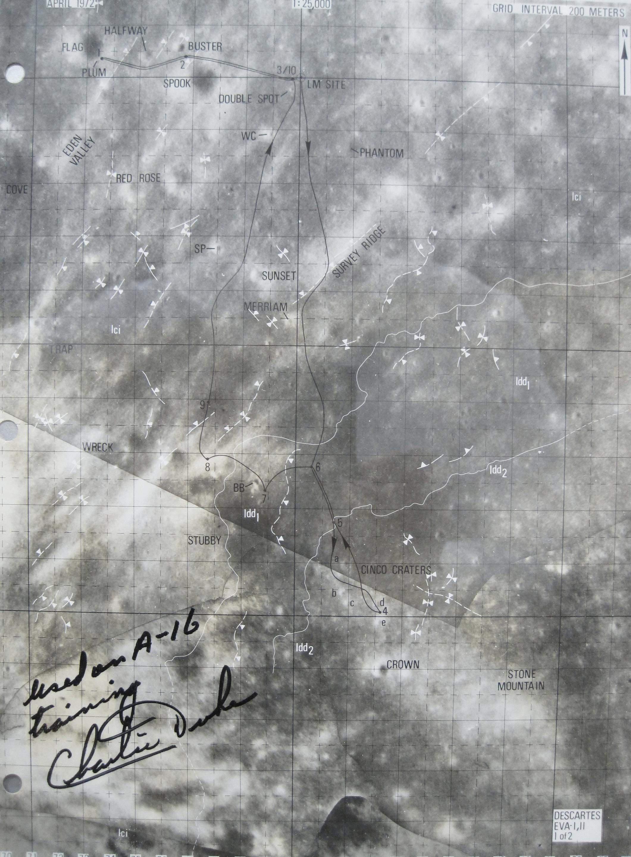
MAP]. FLOWN Apollo 16 Lunar Surface Excursion Map With Lunar Dust. 8 x 10 in. print from an orbital photo of the Moon's surface, printed 200-meter grid intervals with degrees, sites and traverse routes clearly labeled, three-ring punched along top-edge, scale 1:12,500. A RARE AND IMPORTANT ARTIFACT OF CARTOGRAPHY AND EXPLORATION: A MAP USED TO NAVIGATE ON THE MOON'S SURFACE. Lunar surface excursion maps were used extensively in later Apollo missions, from Apollo 14 to 17. During the first two lunar landing missions, Apollo 11 and 12, the astronauts contained their moonwalks to the area within the immediate vicinity of the Lunar Module. In these very limited excursions, a general landing site map was sufficient and noted the prominent features, such as craters in the area. Beginning with Apollo 14, the crew traveled approximately one mile from the LM via foot. This required a much more detailed map and a high-resolution photomap of the traverse route were issued. Two such maps were provided one for each EVA, centered on the prime-landing site. Two additional maps were flown on Apollo 14 as contingency in the event that the landing of the Lunar Module was significantly downrange from the intended site. Each secondary set contained two maps. Apollo 15 saw the introduction of the familiar "dune buggy" lunar rovers to extend exploration of the surface. The three EVAs required 5 maps recording the driving traverses, with much overlap of the areas depicted. Planning the most extensive lunar exploration to that date, Apollo 16 carried a set of 10 traverse charts, issued in a binder atlas. These enabled the crew to travel 2.5 miles away from the LM, again using the lunar rovers. The present lot is one of the maps from this set and titled in the bottom right corner Descartes EVA-II , denoting it's use on the second planned surface excursion. The areas depicted are "Red Rose", "Sunset", "Merriam", "Phantom" and "Survey Ridge" in the center of the map. "Eden Valley", "Cove" and "Trap" are labeled along the B coordinates of the map's left side. The two roughly parallel traverse lines of driving routes cross the center of the map and would have been continued on one of the preceding or following maps in the binder atlas. SIGNED BY ASTRONAUT CHARLIE DUKE on the verso, "In all probablilty the dark smudges are lunar dust from direct contact with the surface." Duke held this map in his hand, navigating as John Young drove the rover into completely new terrain. The final Apollo mission carried 5 maps, some of which are currently on display at the Smithsonian. With a limted number of lunar excursion maps produced and very few carried back to Earth, the present lot is a rare opportunity to acquire a critical component of lunar exploration as used on the surface.
MAP]. FLOWN Apollo 16 Lunar Surface Excursion Map With Lunar Dust. 8 x 10 in. print from an orbital photo of the Moon's surface, printed 200-meter grid intervals with degrees, sites and traverse routes clearly labeled, three-ring punched along top-edge, scale 1:12,500. A RARE AND IMPORTANT ARTIFACT OF CARTOGRAPHY AND EXPLORATION: A MAP USED TO NAVIGATE ON THE MOON'S SURFACE. Lunar surface excursion maps were used extensively in later Apollo missions, from Apollo 14 to 17. During the first two lunar landing missions, Apollo 11 and 12, the astronauts contained their moonwalks to the area within the immediate vicinity of the Lunar Module. In these very limited excursions, a general landing site map was sufficient and noted the prominent features, such as craters in the area. Beginning with Apollo 14, the crew traveled approximately one mile from the LM via foot. This required a much more detailed map and a high-resolution photomap of the traverse route were issued. Two such maps were provided one for each EVA, centered on the prime-landing site. Two additional maps were flown on Apollo 14 as contingency in the event that the landing of the Lunar Module was significantly downrange from the intended site. Each secondary set contained two maps. Apollo 15 saw the introduction of the familiar "dune buggy" lunar rovers to extend exploration of the surface. The three EVAs required 5 maps recording the driving traverses, with much overlap of the areas depicted. Planning the most extensive lunar exploration to that date, Apollo 16 carried a set of 10 traverse charts, issued in a binder atlas. These enabled the crew to travel 2.5 miles away from the LM, again using the lunar rovers. The present lot is one of the maps from this set and titled in the bottom right corner Descartes EVA-II , denoting it's use on the second planned surface excursion. The areas depicted are "Red Rose", "Sunset", "Merriam", "Phantom" and "Survey Ridge" in the center of the map. "Eden Valley", "Cove" and "Trap" are labeled along the B coordinates of the map's left side. The two roughly parallel traverse lines of driving routes cross the center of the map and would have been continued on one of the preceding or following maps in the binder atlas. SIGNED BY ASTRONAUT CHARLIE DUKE on the verso, "In all probablilty the dark smudges are lunar dust from direct contact with the surface." Duke held this map in his hand, navigating as John Young drove the rover into completely new terrain. The final Apollo mission carried 5 maps, some of which are currently on display at the Smithsonian. With a limted number of lunar excursion maps produced and very few carried back to Earth, the present lot is a rare opportunity to acquire a critical component of lunar exploration as used on the surface.


.jpg)




Try LotSearch and its premium features for 7 days - without any costs!
Be notified automatically about new items in upcoming auctions.
Create an alert