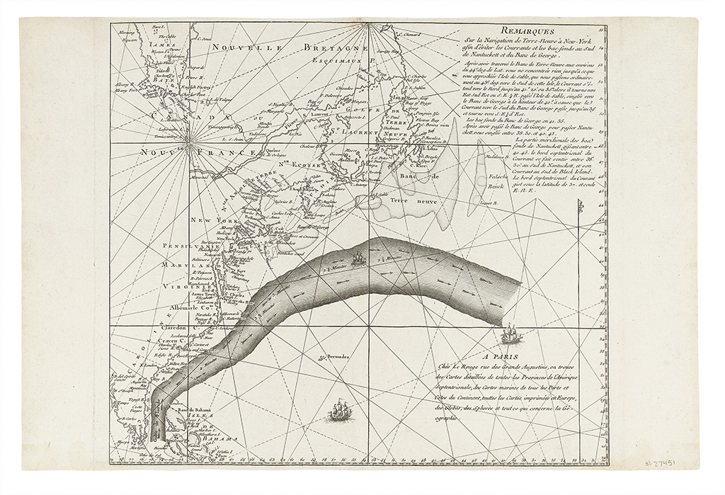
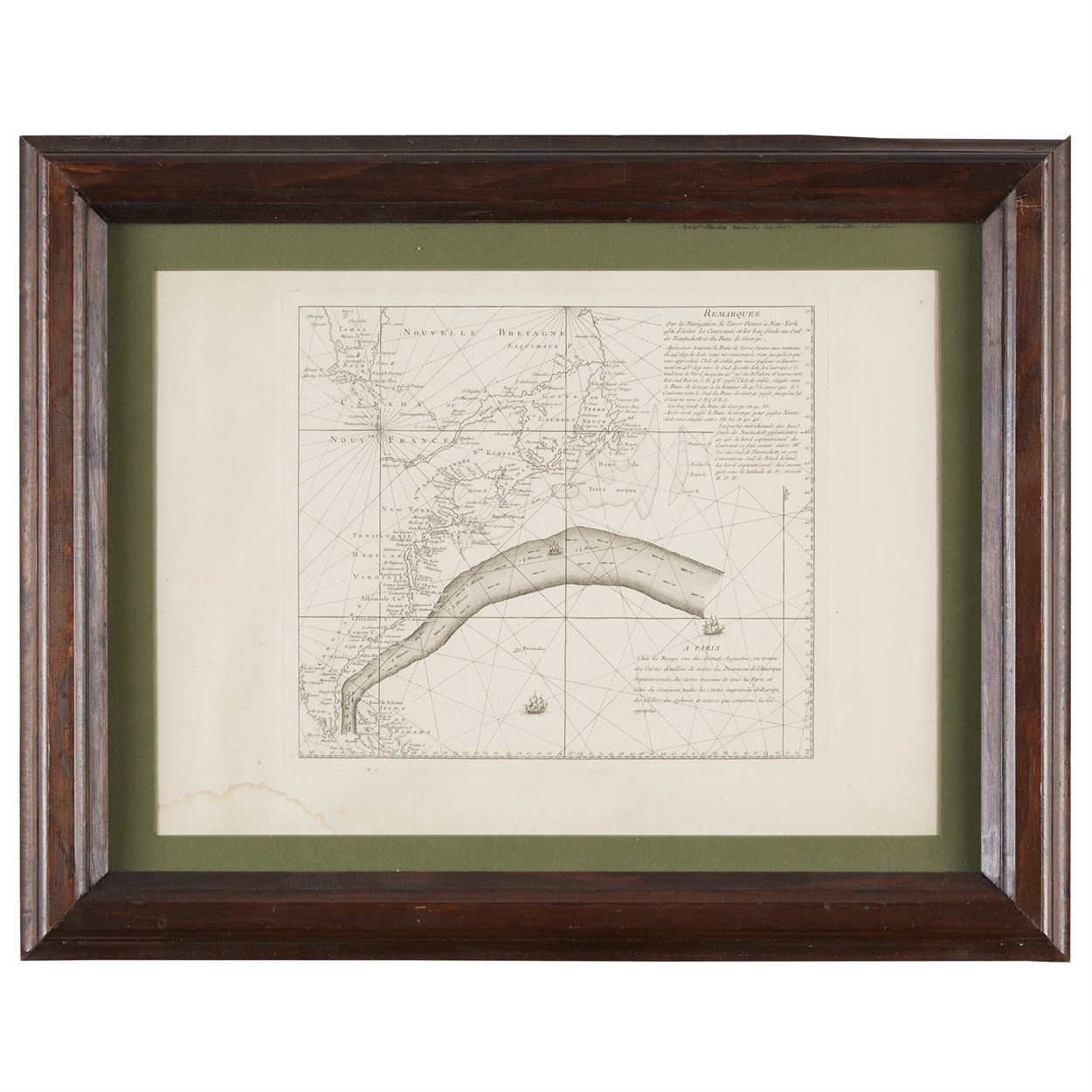
Title: Remarques Sur la Navigation de Terre-Neuve à New-York afin d'éviter les Courrants et les bas-fonds au Sud de Nantuckett et du Banc de George Author: Franklin, Benjamin and Georges-Louis Le Rouge Place: Paris Publisher: Date: c.1780-83 Description: Engraved map. 32x36 cm (12½x14¼"), with wide margins. Rare, separately published chart showing the Gulf Stream and the east coast of North America from Florida to Newfoundland. On the map, the Gulf Stream is flowing from Florida to the mid-Atlantic. Beneath the text, sailing directions are given for avoiding the Gulf Stream. An untrimmed, wide-margined example of the earliest acquirable and most accurate of Franklin’s charts of the Gulf Stream, his single greatest contribution to cartography. It is believed Franklin sought out Le Rouge for the publication of this chart between 1781 and 1783, when he was a minister to the French court. Benjamin Franklin began his study of the Gulf Stream in 1768, while serving as the postmaster of the British Colonies in North America, and he worked with his cousin Timothy Folger, in charting the phenomenon. In 1775 and 1776, Franklin made two Atlantic crossings, during which time he tested the water temperatures in and out of the Gulf Stream and determined that the waters in the stream were warmer. This revived his interest in the Folger chart. On his arrival in Paris, he had it copied and printed by Le Rouge. Franklin intended to provide copies to all French ship captains carrying arms and supplies to the American colonies. Further Notes from the Files of Warren Heckrotte Full title: Remarques Sur la Navigation de Terre - Neuve à New - York afin d'éviter les Courrants et les bas - fonds au Sud de Nantuckett et du Banc de George. | A Paris Chés Le Rouge rue des Grands Augustins, on trouve des Cartes détaillées de tortes les Provinces de l'Amérique Septentrionale, des Cartes marines de tous les Ports et Côtes du Continent, toutes les Cartes imprimées en Europe, des Globes, des Spheres et tout ce que concerne la Géographie. Watermark: Grapes with c-k; probably Heawood 2395. Provenance: J. Norman, '76 An earlier map showing the Gulf Stream was published by Mount and Page of Europe, Africa, & America in four sheets, a copy of which was located only in recent years by P.L. Richardson. However, on this map the Gulf Stream was engraved on an old plate. References: Brown, Lloyd A. "The River in the Ocean" in Essays Honoring Lawerence C. Wroth. Stommel, H., The Gulf Stream: A Physical and Dynamical Description. Vorsey, IM 28, pp 105-120 ( Rep ). These were written before the discovery of the original English map. Richardson, P.L., "Benjamin Fraklin and Timothy Folger's First Printed Chart of the Gulf Stream", Science, Vol. 207, 8 February 1980 pp 643-645. ( Rep of Mount and Page map ). Cohn, Ellen R., "Benjamin Franklin, Georges-Louis Le Rouge and the Franklin/Folger Chart of the Gulf Stream" in IM 52, 2000, pp 124-142 (Rep). An informative article on the circumstances of the publication of the Le Rouge map. De Vorsey, Louis, "Poor Benjamin's Chart" IMCOS Journal, Spring 2004, pp 5-14. Lot Amendments Condition: A few spots and a small stain in the margins; map fine. Item number: 267407
Title: Remarques Sur la Navigation de Terre-Neuve à New-York afin d'éviter les Courrants et les bas-fonds au Sud de Nantuckett et du Banc de George Author: Franklin, Benjamin and Georges-Louis Le Rouge Place: Paris Publisher: Date: c.1780-83 Description: Engraved map. 32x36 cm (12½x14¼"), with wide margins. Rare, separately published chart showing the Gulf Stream and the east coast of North America from Florida to Newfoundland. On the map, the Gulf Stream is flowing from Florida to the mid-Atlantic. Beneath the text, sailing directions are given for avoiding the Gulf Stream. An untrimmed, wide-margined example of the earliest acquirable and most accurate of Franklin’s charts of the Gulf Stream, his single greatest contribution to cartography. It is believed Franklin sought out Le Rouge for the publication of this chart between 1781 and 1783, when he was a minister to the French court. Benjamin Franklin began his study of the Gulf Stream in 1768, while serving as the postmaster of the British Colonies in North America, and he worked with his cousin Timothy Folger, in charting the phenomenon. In 1775 and 1776, Franklin made two Atlantic crossings, during which time he tested the water temperatures in and out of the Gulf Stream and determined that the waters in the stream were warmer. This revived his interest in the Folger chart. On his arrival in Paris, he had it copied and printed by Le Rouge. Franklin intended to provide copies to all French ship captains carrying arms and supplies to the American colonies. Further Notes from the Files of Warren Heckrotte Full title: Remarques Sur la Navigation de Terre - Neuve à New - York afin d'éviter les Courrants et les bas - fonds au Sud de Nantuckett et du Banc de George. | A Paris Chés Le Rouge rue des Grands Augustins, on trouve des Cartes détaillées de tortes les Provinces de l'Amérique Septentrionale, des Cartes marines de tous les Ports et Côtes du Continent, toutes les Cartes imprimées en Europe, des Globes, des Spheres et tout ce que concerne la Géographie. Watermark: Grapes with c-k; probably Heawood 2395. Provenance: J. Norman, '76 An earlier map showing the Gulf Stream was published by Mount and Page of Europe, Africa, & America in four sheets, a copy of which was located only in recent years by P.L. Richardson. However, on this map the Gulf Stream was engraved on an old plate. References: Brown, Lloyd A. "The River in the Ocean" in Essays Honoring Lawerence C. Wroth. Stommel, H., The Gulf Stream: A Physical and Dynamical Description. Vorsey, IM 28, pp 105-120 ( Rep ). These were written before the discovery of the original English map. Richardson, P.L., "Benjamin Fraklin and Timothy Folger's First Printed Chart of the Gulf Stream", Science, Vol. 207, 8 February 1980 pp 643-645. ( Rep of Mount and Page map ). Cohn, Ellen R., "Benjamin Franklin, Georges-Louis Le Rouge and the Franklin/Folger Chart of the Gulf Stream" in IM 52, 2000, pp 124-142 (Rep). An informative article on the circumstances of the publication of the Le Rouge map. De Vorsey, Louis, "Poor Benjamin's Chart" IMCOS Journal, Spring 2004, pp 5-14. Lot Amendments Condition: A few spots and a small stain in the margins; map fine. Item number: 267407


Try LotSearch and its premium features for 7 days - without any costs!
Be notified automatically about new items in upcoming auctions.
Create an alert