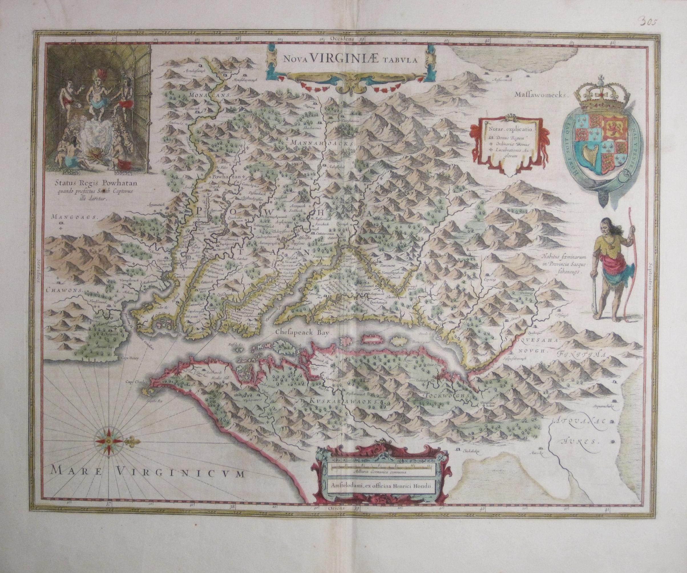
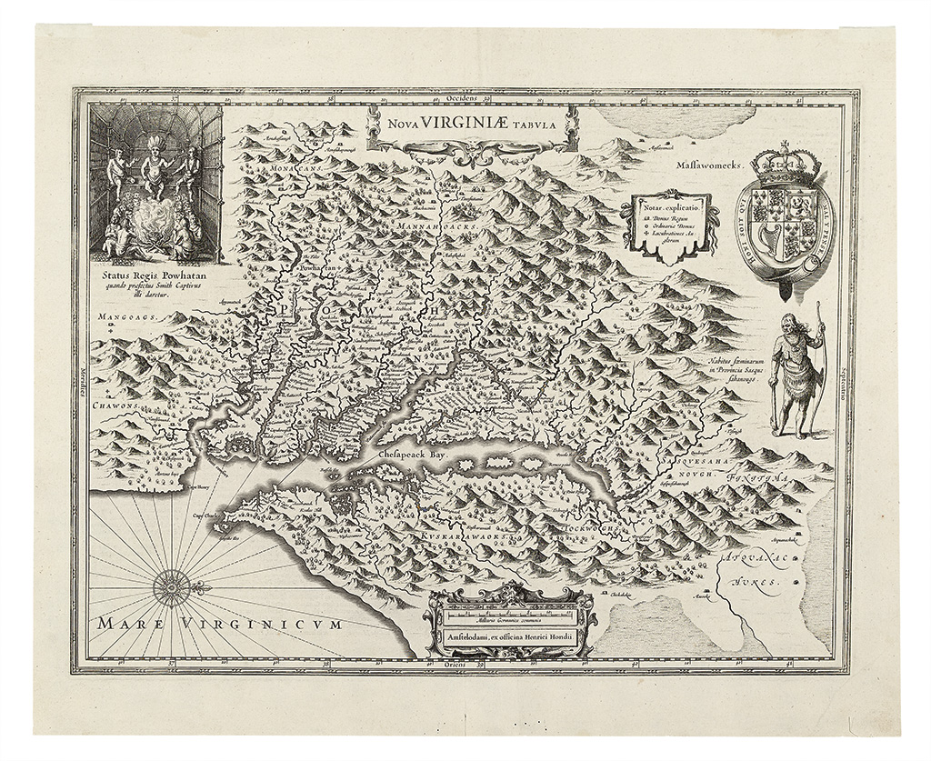
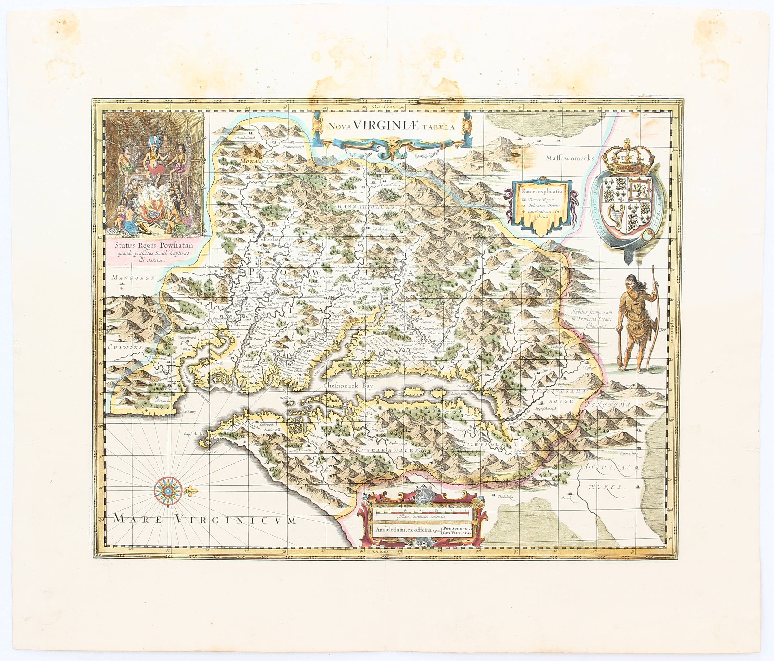
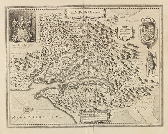
VIRGINIA]. HONDIUS, Henricus. Nova Virginae Tabula . Amsterdam: Hondius, [1647 or 1649]. Engraved map, partially hand-colored, 381 x 492 mm (503 x 562 mm sheet). Latin text on verso. (A few closed tears along fold and at upper sheet edge, some light soiling.) Derivative 5, state 1 of Smith's map of Virginia, a copy of the Hondius-Blaeu plate of 1629, and used in Mercator's L'Appendice de l'Atlas... . The present conforms to Verner's impressions of the Latin-text issues of 1647 or 1649. Burden 228; Koeman II:345; Coolie Verner in Tooley, The Mapping of America , chapter 4, p.166. -- BLAEU, Willem and Jan. Nova Virginiae Tabula . [Amsterdam, 1658/65]. Engraved map, partially hand-colored, 379 x 485 mm platemark (461 x 621 mm sheet). Dutch text on verso. (Lightly reinforced along central fold on verso.) This is derivative 1, second state (of 2), bearing the imprint of Blaeu. Originally issued by Jodocus Hondius from 1618-1629, the map closely follows State 1 of Smith's Virginia of 1612, without longitude and the various names added in Smith's later states. Koeman I:71-5; Coolie Verner in Tooley, The Mapping of America , chapter 4, p.166. -- BELLIN, Jacques Nicolas (1703-1772) and others. Carte réduite des côtes orientales de l'Amerique Septentrionale. Contenant partie du Nouveau Jersey, la Pen-Sylvanie, le Mary-land, la Virginie, la Caroline Septentrionale, la Caroline Méridionale et la Georgie... par ordre de M. de Sartine . [Paris:] Depot General de la Marine, 1778. Engraved map, 610 x 898 mm (645 x 946 mm sheet). (A few pale spots.) Phillips Atlases 590, map 61. -- [WASHINGTON, D.C.]. Plan of the City of Washington in the Territory of Columbia ceded by the States of Virginia and Maryland to the United States of America and by them established as the seat of their Government after the Year 1800 . [New York: John Reid ca 1795]. Engraved map by Rollinson, 399 x 520 mm image (514 x 538 mm sheet). (Trimmed within platemark and left border cropped, a few closed tears, pale stain at upper left corner.) Howes W581; Phillips Atlases 1216; Phillips Maps , p.1005. (4)
VIRGINIA]. HONDIUS, Henricus. Nova Virginae Tabula . Amsterdam: Hondius, [1647 or 1649]. Engraved map, partially hand-colored, 381 x 492 mm (503 x 562 mm sheet). Latin text on verso. (A few closed tears along fold and at upper sheet edge, some light soiling.) Derivative 5, state 1 of Smith's map of Virginia, a copy of the Hondius-Blaeu plate of 1629, and used in Mercator's L'Appendice de l'Atlas... . The present conforms to Verner's impressions of the Latin-text issues of 1647 or 1649. Burden 228; Koeman II:345; Coolie Verner in Tooley, The Mapping of America , chapter 4, p.166. -- BLAEU, Willem and Jan. Nova Virginiae Tabula . [Amsterdam, 1658/65]. Engraved map, partially hand-colored, 379 x 485 mm platemark (461 x 621 mm sheet). Dutch text on verso. (Lightly reinforced along central fold on verso.) This is derivative 1, second state (of 2), bearing the imprint of Blaeu. Originally issued by Jodocus Hondius from 1618-1629, the map closely follows State 1 of Smith's Virginia of 1612, without longitude and the various names added in Smith's later states. Koeman I:71-5; Coolie Verner in Tooley, The Mapping of America , chapter 4, p.166. -- BELLIN, Jacques Nicolas (1703-1772) and others. Carte réduite des côtes orientales de l'Amerique Septentrionale. Contenant partie du Nouveau Jersey, la Pen-Sylvanie, le Mary-land, la Virginie, la Caroline Septentrionale, la Caroline Méridionale et la Georgie... par ordre de M. de Sartine . [Paris:] Depot General de la Marine, 1778. Engraved map, 610 x 898 mm (645 x 946 mm sheet). (A few pale spots.) Phillips Atlases 590, map 61. -- [WASHINGTON, D.C.]. Plan of the City of Washington in the Territory of Columbia ceded by the States of Virginia and Maryland to the United States of America and by them established as the seat of their Government after the Year 1800 . [New York: John Reid ca 1795]. Engraved map by Rollinson, 399 x 520 mm image (514 x 538 mm sheet). (Trimmed within platemark and left border cropped, a few closed tears, pale stain at upper left corner.) Howes W581; Phillips Atlases 1216; Phillips Maps , p.1005. (4)
VIRGINIA]. HONDIUS, Henricus. Nova Virginae Tabula . Amsterdam: Hondius, [1647 or 1649]. Engraved map, partially hand-colored, 381 x 492 mm (503 x 562 mm sheet). Latin text on verso. (A few closed tears along fold and at upper sheet edge, some light soiling.) Derivative 5, state 1 of Smith's map of Virginia, a copy of the Hondius-Blaeu plate of 1629, and used in Mercator's L'Appendice de l'Atlas... . The present conforms to Verner's impressions of the Latin-text issues of 1647 or 1649. Burden 228; Koeman II:345; Coolie Verner in Tooley, The Mapping of America , chapter 4, p.166. -- BLAEU, Willem and Jan. Nova Virginiae Tabula . [Amsterdam, 1658/65]. Engraved map, partially hand-colored, 379 x 485 mm platemark (461 x 621 mm sheet). Dutch text on verso. (Lightly reinforced along central fold on verso.) This is derivative 1, second state (of 2), bearing the imprint of Blaeu. Originally issued by Jodocus Hondius from 1618-1629, the map closely follows State 1 of Smith's Virginia of 1612, without longitude and the various names added in Smith's later states. Koeman I:71-5; Coolie Verner in Tooley, The Mapping of America , chapter 4, p.166. -- BELLIN, Jacques Nicolas (1703-1772) and others. Carte réduite des côtes orientales de l'Amerique Septentrionale. Contenant partie du Nouveau Jersey, la Pen-Sylvanie, le Mary-land, la Virginie, la Caroline Septentrionale, la Caroline Méridionale et la Georgie... par ordre de M. de Sartine . [Paris:] Depot General de la Marine, 1778. Engraved map, 610 x 898 mm (645 x 946 mm sheet). (A few pale spots.) Phillips Atlases 590, map 61. -- [WASHINGTON, D.C.]. Plan of the City of Washington in the Territory of Columbia ceded by the States of Virginia and Maryland to the United States of America and by them established as the seat of their Government after the Year 1800 . [New York: John Reid ca 1795]. Engraved map by Rollinson, 399 x 520 mm image (514 x 538 mm sheet). (Trimmed within platemark and left border cropped, a few closed tears, pale stain at upper left corner.) Howes W581; Phillips Atlases 1216; Phillips Maps , p.1005. (4)
VIRGINIA]. HONDIUS, Henricus. Nova Virginae Tabula . Amsterdam: Hondius, [1647 or 1649]. Engraved map, partially hand-colored, 381 x 492 mm (503 x 562 mm sheet). Latin text on verso. (A few closed tears along fold and at upper sheet edge, some light soiling.) Derivative 5, state 1 of Smith's map of Virginia, a copy of the Hondius-Blaeu plate of 1629, and used in Mercator's L'Appendice de l'Atlas... . The present conforms to Verner's impressions of the Latin-text issues of 1647 or 1649. Burden 228; Koeman II:345; Coolie Verner in Tooley, The Mapping of America , chapter 4, p.166. -- BLAEU, Willem and Jan. Nova Virginiae Tabula . [Amsterdam, 1658/65]. Engraved map, partially hand-colored, 379 x 485 mm platemark (461 x 621 mm sheet). Dutch text on verso. (Lightly reinforced along central fold on verso.) This is derivative 1, second state (of 2), bearing the imprint of Blaeu. Originally issued by Jodocus Hondius from 1618-1629, the map closely follows State 1 of Smith's Virginia of 1612, without longitude and the various names added in Smith's later states. Koeman I:71-5; Coolie Verner in Tooley, The Mapping of America , chapter 4, p.166. -- BELLIN, Jacques Nicolas (1703-1772) and others. Carte réduite des côtes orientales de l'Amerique Septentrionale. Contenant partie du Nouveau Jersey, la Pen-Sylvanie, le Mary-land, la Virginie, la Caroline Septentrionale, la Caroline Méridionale et la Georgie... par ordre de M. de Sartine . [Paris:] Depot General de la Marine, 1778. Engraved map, 610 x 898 mm (645 x 946 mm sheet). (A few pale spots.) Phillips Atlases 590, map 61. -- [WASHINGTON, D.C.]. Plan of the City of Washington in the Territory of Columbia ceded by the States of Virginia and Maryland to the United States of America and by them established as the seat of their Government after the Year 1800 . [New York: John Reid ca 1795]. Engraved map by Rollinson, 399 x 520 mm image (514 x 538 mm sheet). (Trimmed within platemark and left border cropped, a few closed tears, pale stain at upper left corner.) Howes W581; Phillips Atlases 1216; Phillips Maps , p.1005. (4)


Try LotSearch and its premium features for 7 days - without any costs!
Be notified automatically about new items in upcoming auctions.
Create an alert