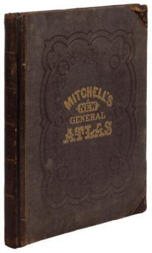
Title: Mitchell's New General Atlas, Containing Maps of the Various Countries of the World, Plans of Cities, Etc.... Author: Mitchell, S[amuel] Augustus Place: Philadelphia Publisher: S. Augustus Mitchell, Jr. Date: 1860 Description: With 53 hand-colored maps and plans (4 are double-page), plus numerous inset maps; all on 43 map-sheets. 15½x13, original quarter brown sheep and cloth, front cover lettered in gilt. Mitchell’s 1860 general atlas, with 22 of the maps pertaining to the United States, including full-page maps of Maine, Plans of New York and Brooklyn, Boston, Philadelphia, Baltimore, Cincinnati, Texas, California, etc. Double-page maps include: The World; United States; New York with New Hampshire, Vermont, Massachusetts, Rhode Island and Connecticut; Mexico, Central America and West Indies. Other world maps include: Mexico, Central America and the West Indies; South America; Brazil; Europe; England and Wales; Scotland; Ireland; Asia; Oceanica; Africa, etc. List of the U.S. post offices and populations, mountains and rivers, all in the back. Phillips Atlases 831. Lot Amendments Condition: Spine worn (splits and chips to lower half), edge wear and soiling; binding shaken, first four leaves loosely laid in (including title page), dampstains to endpapers, mild toning and finger-soiling to maps (cheifly to margins); contents still very good - binding needs some repair. Item number: 144365
Title: Mitchell's New General Atlas, Containing Maps of the Various Countries of the World, Plans of Cities, Etc.... Author: Mitchell, S[amuel] Augustus Place: Philadelphia Publisher: S. Augustus Mitchell, Jr. Date: 1860 Description: With 53 hand-colored maps and plans (4 are double-page), plus numerous inset maps; all on 43 map-sheets. 15½x13, original quarter brown sheep and cloth, front cover lettered in gilt. Mitchell’s 1860 general atlas, with 22 of the maps pertaining to the United States, including full-page maps of Maine, Plans of New York and Brooklyn, Boston, Philadelphia, Baltimore, Cincinnati, Texas, California, etc. Double-page maps include: The World; United States; New York with New Hampshire, Vermont, Massachusetts, Rhode Island and Connecticut; Mexico, Central America and West Indies. Other world maps include: Mexico, Central America and the West Indies; South America; Brazil; Europe; England and Wales; Scotland; Ireland; Asia; Oceanica; Africa, etc. List of the U.S. post offices and populations, mountains and rivers, all in the back. Phillips Atlases 831. Lot Amendments Condition: Spine worn (splits and chips to lower half), edge wear and soiling; binding shaken, first four leaves loosely laid in (including title page), dampstains to endpapers, mild toning and finger-soiling to maps (cheifly to margins); contents still very good - binding needs some repair. Item number: 144365


Try LotSearch and its premium features for 7 days - without any costs!
Be notified automatically about new items in upcoming auctions.
Create an alert